The alarm was set for 2:30 am because my lifelong friend and hiking sensei, Mike, and I had agreed to take our first steps down the South Kaibab Trail into the Grand Canyon for a 20+ mile “Rim to River to Rim” hike at 4:00 am. In training, Mike shared it was pretty important to him to get started on time, and as his friend and hiking partner, I agreed to make that happen, even though I was a little nervous about descending in the dark, and I am not thrilled about waking early, ever. I reconciled that with the time change in Arizona, we would really be waking at 5:30 am Eastern (our time), and that’s sometimes possible for me with a cup of coffee and a purpose. I had both. To be at the trailhead at 4:00 am, we had to be in the cab from Maswik Lodge in Grand Canyon Park at 3:30 am. We called the day before, and the woman at the taxi dispatch had told us not to call for a cab until we had “backpacks on and coffee in hand.” They’re that good. We’d be ready.
WHAT WE DID.
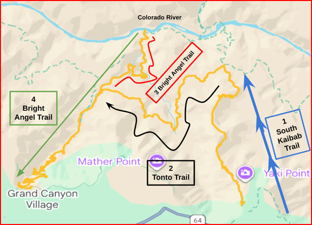
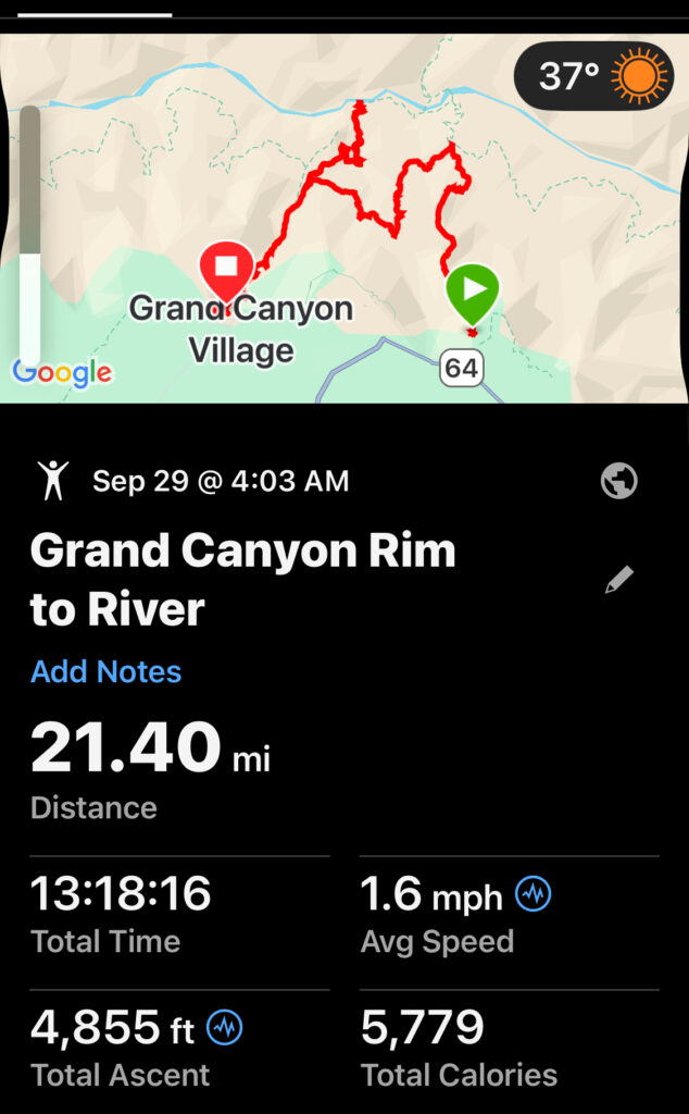
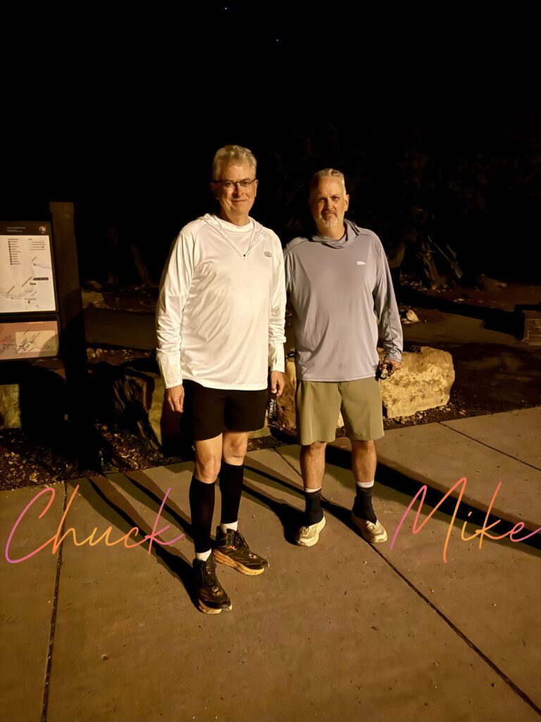
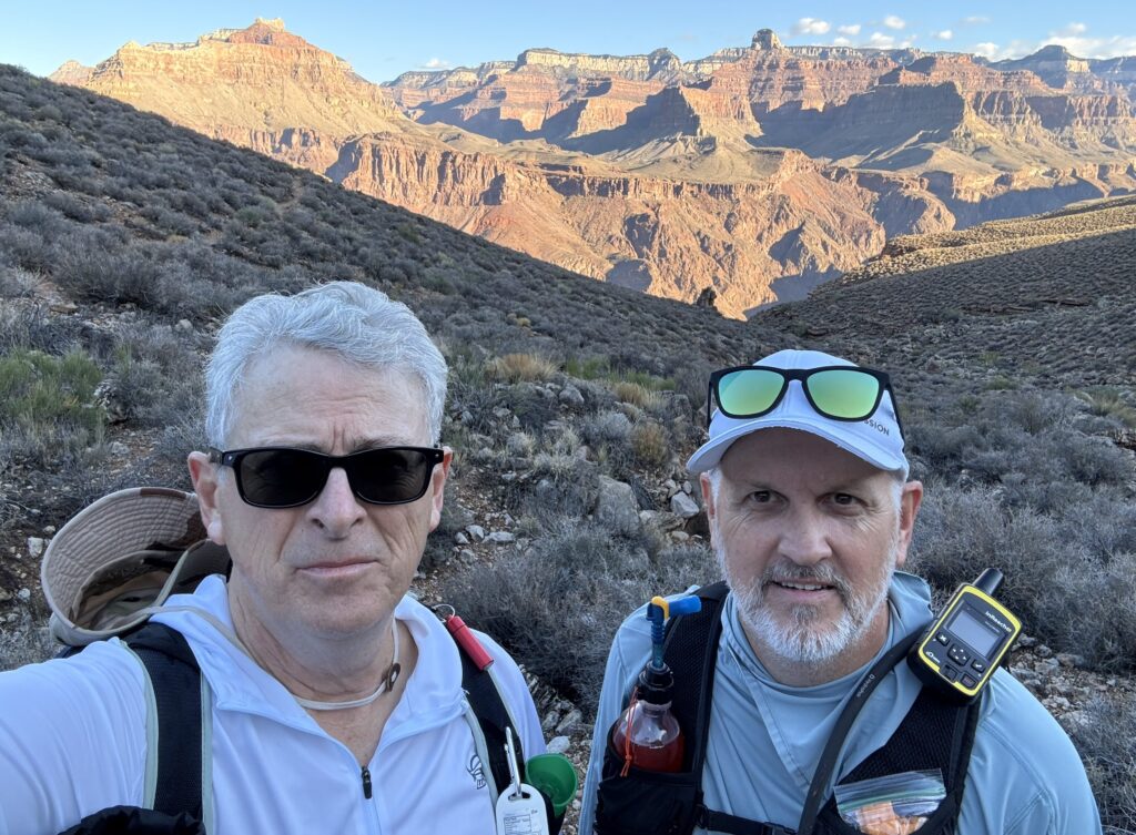
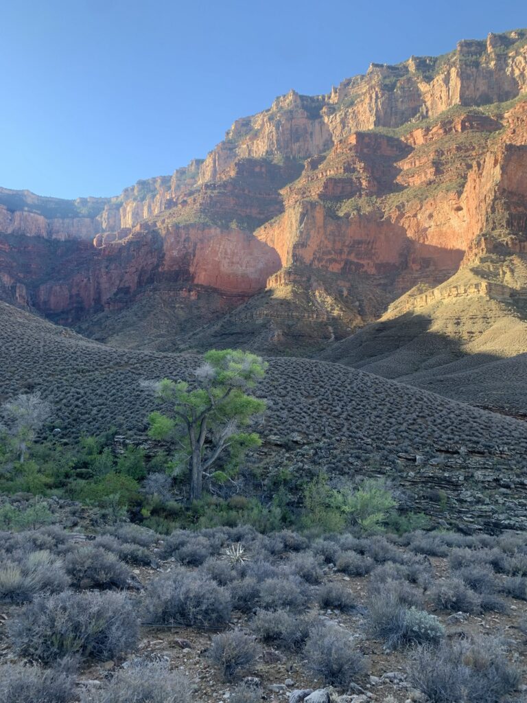
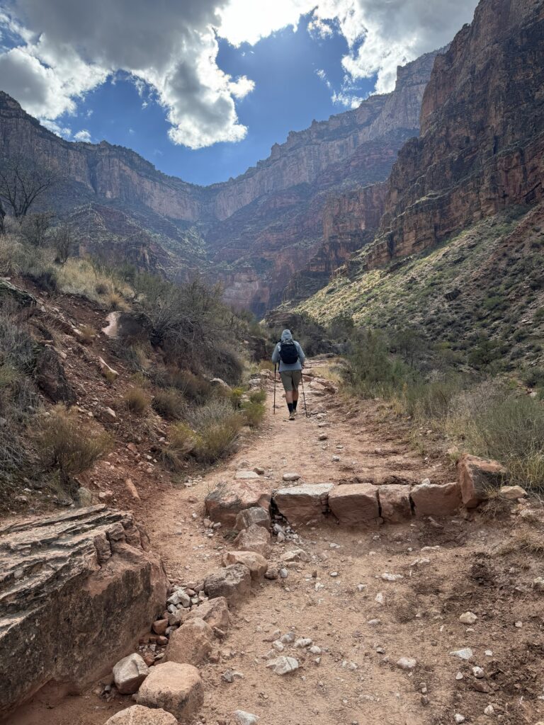
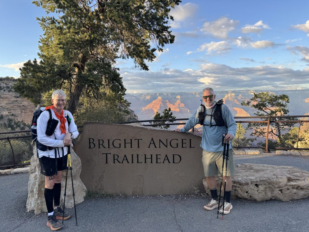
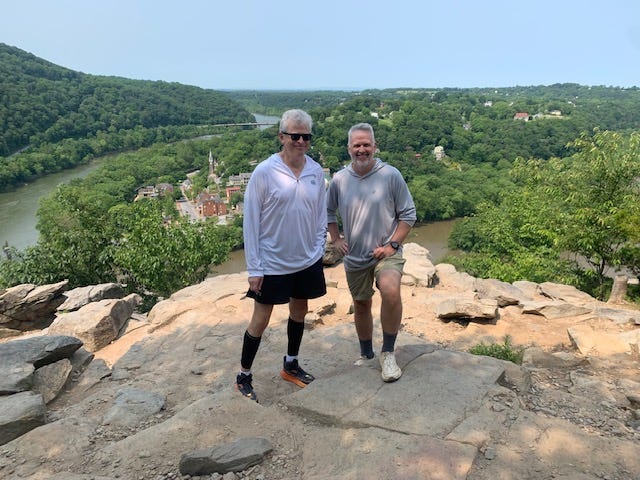
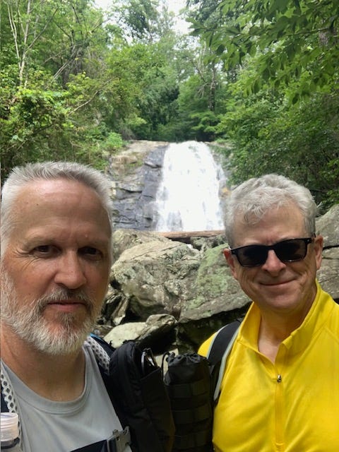
On Monday, September 29, 2025, Mike and I set out to hike the Grand Canyon Rim to River; South Kaibab-Tonto-Bright Angel trails to the Colorado River, and back up Bright Angel to the South Rim. (Spoiler alert – we did it.) My Garmin GPS watch says 21.4 miles in 13 hours, 18 minutes. We started at 4:03 am and enjoyed weather that was maybe 10 degrees cooler than usual — a blessing. Our original plan was a genuine “Rim to Rim” (R2R), down one side, across the canyon, and back up the other. When the North Rim burned down in July 2025, closing the northern trails, like so many hikers, we changed to Rim to River rather than not hike the Grand Canyon at all.
WHO AM I? HOW DID I GET HERE?
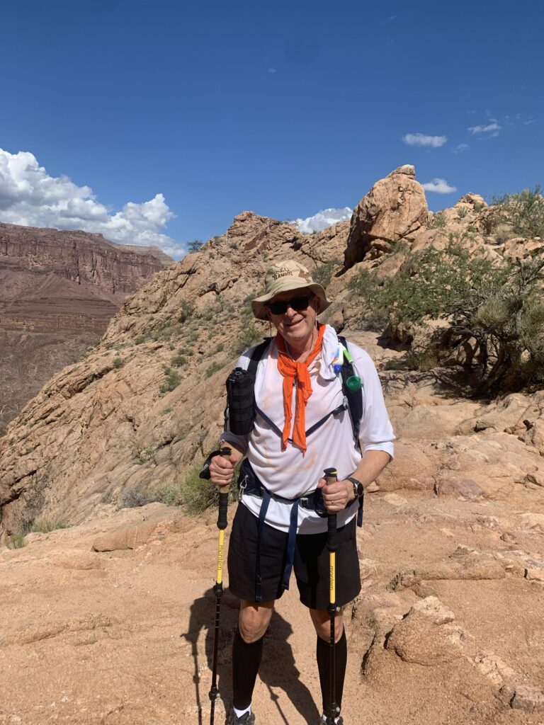
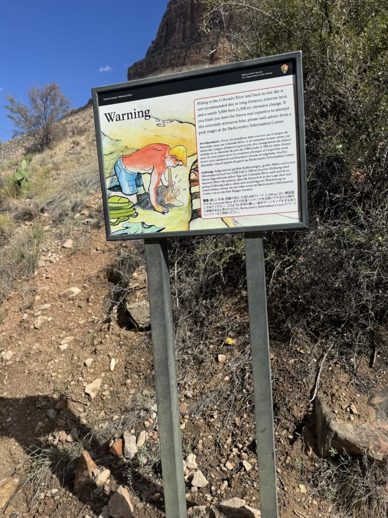
Me? A 65-year-old, semi-retired average guy, a bit of a slacker, who somehow ran 30 marathons (including three ultras) from age 40 to 55. No elite athlete by any means. I’m 6’4” and 220 pounds — a Clydesdale. In the past ten years, I’ve been blessed to make it successfully through throat cancer, blood clots, a pesky heart issue, and a knee replacement. Other than that, I’m a neurotic hypochondriac who sees the glass as half-broken. There were times hiking and training, when I considered it a real possibility that this hike could kill me. Hikers died in the Grand Canyon already this year. Some of my angst was legit, and some was just plain ridiculous. I went anyway. Sometimes more excited about it than others, but I kept moving forward. I love endurance events, and there were lots of similarities between marathon running and hiking, and yet there’s one huge difference — if it goes bad in a marathon, you catch a cab back to your car. Not so much at the bottom of the Grand Canyon. The stakes were higher.
Backing up a bit, two years ago I began planning a solo Grand Canyon Rim-to-Rim (R2R) hike, from the more desolate North Rim down in the canyon to Phantom Ranch, up Bright Angel Trail, finishing at the South Rim. I had actually booked flights and lodging and planned to do the R2R alone in 2024 to acknowledge that my marathon-running days were over due to a bum knee, and find a new challenge. This was before I even knew Mike was also interested in doing it.
My long-distance running days were over, but I could still run 3–4 miles and walk well. Then I couldn’t. The low point may have been a vacation to Ireland with my wife and daughter, during a bus tour stop in the Wicklow Mountains Park. Everyone went for a mile-and-a-half walk to a lake, and the knee hurt so badly I had to sit on a log and let them go ahead. While they hiked, I wept. Arthritis got the better of my right knee, and while by then Mike and I had been working on a loose plan to hike R2R together, we deferred it until 2025, hoping I would recover with physical therapy, drugs, and injections.
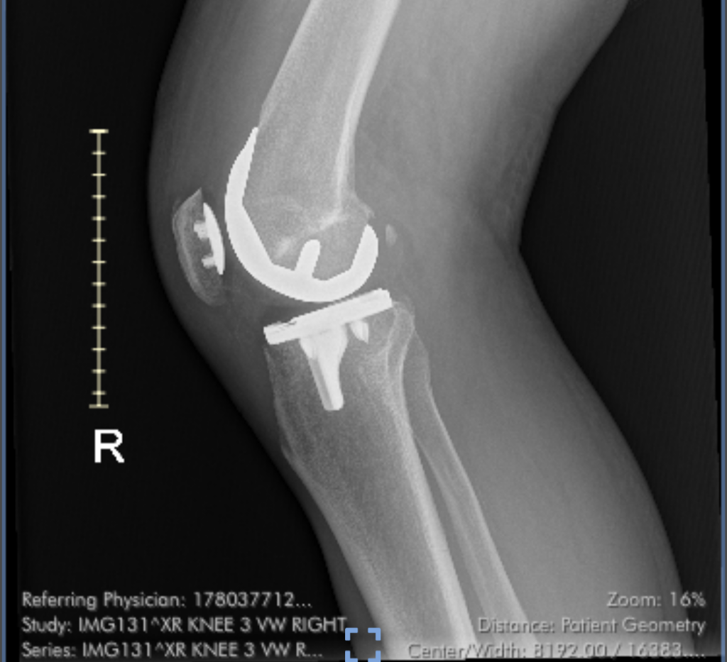
But running ended completely in late 2023, and after a year of limping, I had the offending joint replaced in December 2024. Rehabilitation went extraordinarily well thanks to my physical therapist, Paul, the Knee Whisperer, who knew I wanted to hike the Grand Canyon and pushed me hard and successfully to recover. Two months after surgery, I was surfing the Grand Canyon R2R Facebook page, swapping questions and concerns with other knee replacement old timers, hoping to hike the canyon. Those people could not have been more helpful and inspirational. Some had both knees replaced and were all in!
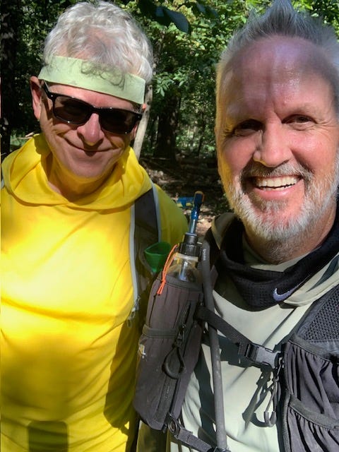
Three months after surgery, my buddy Mike started teaching me to hike. In the spring and summer of 2025, Mike took me on harder and harder hikes, taught me how to choose and use gear, and patiently encouraged me to push forward. By fall, I was hiking almost as strongly as he was. Sadly, the third man in the ring, our dear friend Chris, who is like a brother to us, had hoped to hike the canyon too, but had to pull out early in the planning phase with back surgery. We certainly missed him dearly. Maybe next time?
Unfortunately, the tragic wildfires of July 2025 burned much of the North Rim, closing trail access and Phantom Ranch indefinitely. Our only option, as most of the fall hikers who planned an R2R, was to shift plans to do a Rim To River. It was 20–21 miles and 5,000 feet down (and 5,000 feet back up) and technically not as punishing as the R2R, but certainly no cakewalk. We wondered if it was a consolation prize or an experience in itself. The deciding factor for me was that I’m 65 years old, North Rim repairs could be more than a year out, and I had a hard time imagining me training again in my later(r) 60’s to do an actual R2R hike. Mike is five years younger and more fit. For me, it was now or never to hike into the canyon. And that’s how we ended up at the Grand Canyon National Park’s Maswik Lodge in the wee hours of September 29th to begin our epic hike.
CAN WE GET ON WITH THE HIKE PLEASE?
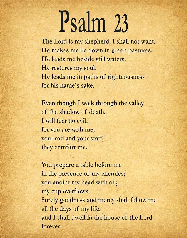
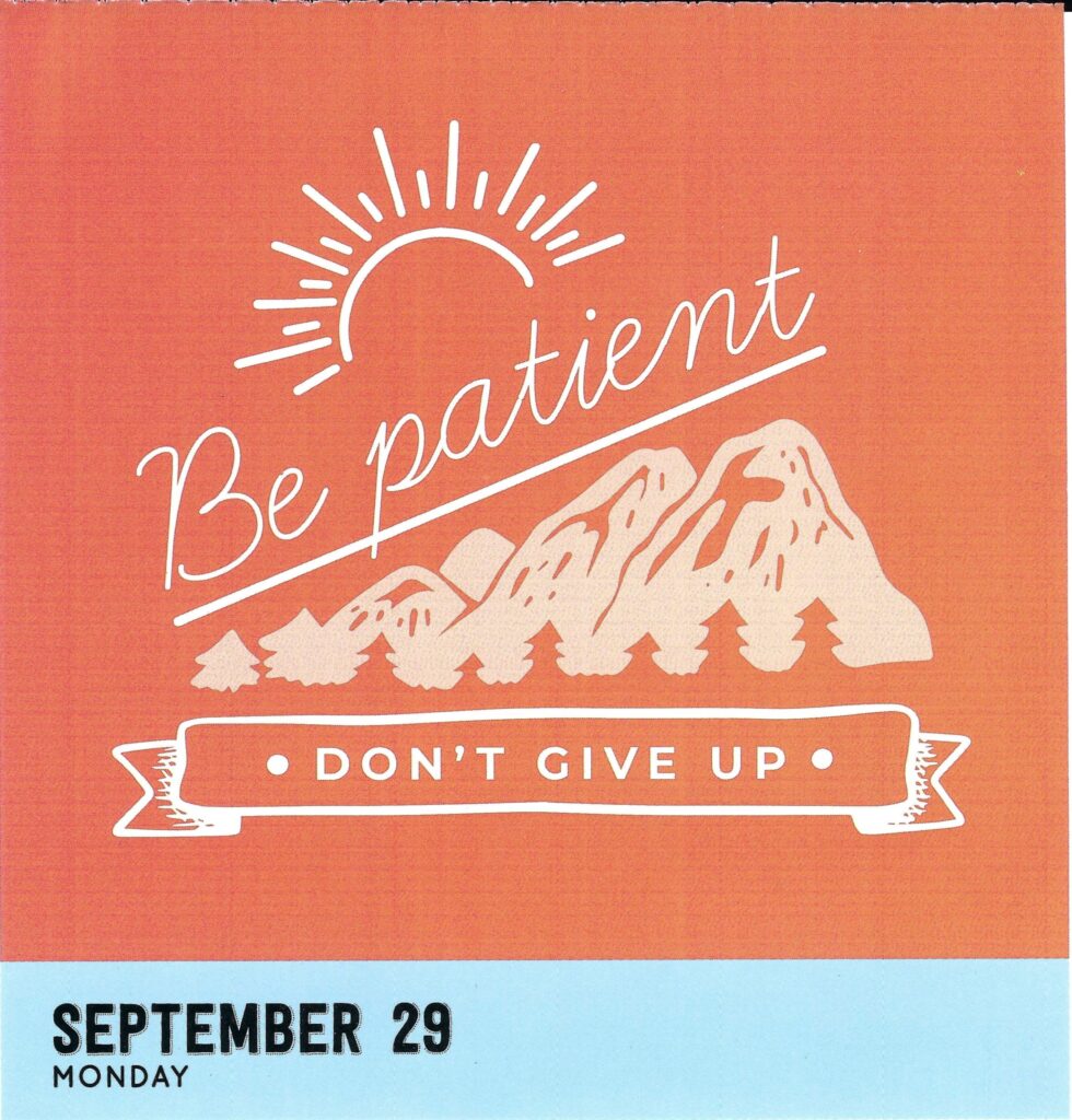
I woke up at 2:20 am before the alarm went off. For just a few minutes, I enjoyed the stillness, and for inspiration, good luck, and reassurance, I opened my Bible app for the random verse of the day. No kidding, it was the 23rd Psalm. Verse 1 “The Lord is my shepherd; I shall not want. He makes me lie down in green pastures. He leads me beside still waters.” Verse 3? “Even though I walk through the valley of the shadow of death, I will fear no evil, for you are with me; your rod and your staff, they comfort me.” Man, that was spooky. A good omen, I decided. (When I returned home a week later, I found on my pillow my wife’s inspirational message from her daily calendar for September 29th, the day of our hike. It was “Be patient. Don’t give up” over a silhouette of a mountain. Really spooky!
Mike and I had spent months planning, overthinking, and preparing for the Grand Canyon hike, and we were hyper-organized. I even had a checklist: sequencing stuffing my backpack with prepared supplies, taking a quick shower to clear my head, dressing, hitting the coffee pot’s start button while I retrieved cold food and drink from the hotel room fridge, packaging them with a small baggie of ice in a small thermal lunch bag, and putting it in the top of the backpack, and donning my cold weather hat and gloves, headlight, trekking poles positioned in front of the door, and at exactly 3:25 am stepped outside to meet Mike. All on the checklist. Well, I stepped out into the glare of the taxi’s headlights approaching, heard my hotel door shut, and realized my coffee was still in the coffee maker. First fail. Back inside quickly and in the cab at 3:30 anyway. With coffee. Almost like the dispatcher said.
I made stupid, nervous jokes the whole 20-minute drive, like I do when I’m scared. Not that I was scared. Much. I ate my first Pop-Tart of the day and downed a bottle of Gatorade for energy, topping off before the hike started, just as I did during marathons. We exited the cab at the trailhead and paid the driver $20 each. The fare was supposed to be $15, and a $5 tip seemed reasonable at that hour. The driver said no; it’s $15 total for the cab, not per person. We said keep it all. Good guy, a pro who dutifully double-checked the backseat after we got out, and we needed the karma. And quite possibly, I was going to die and never need that $20 bill ever again.
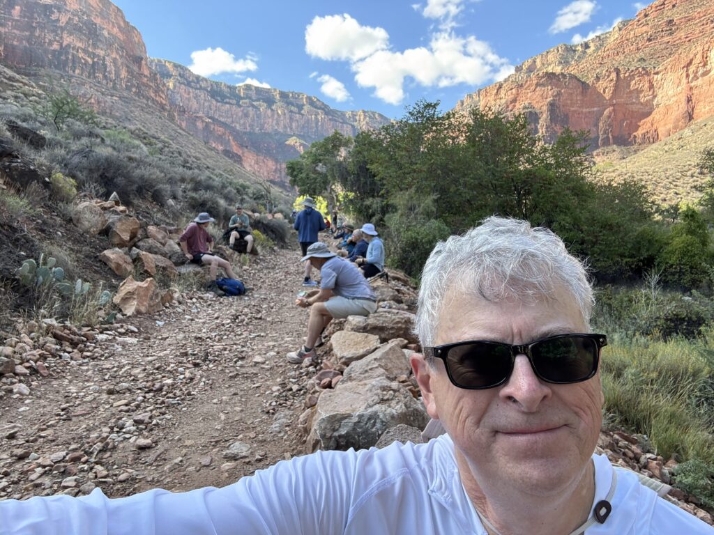
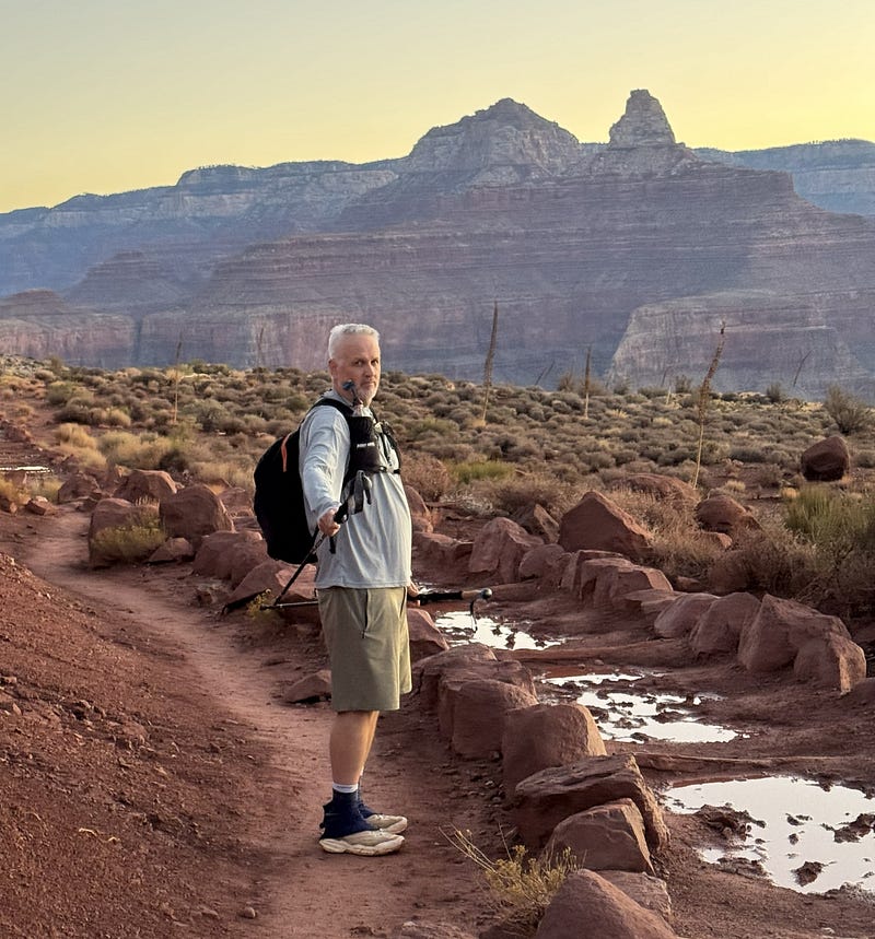
The temperature was in the 40’s on the South Rim, I think, and we were comfortable in shorts, two layers of shirts, hats, and gloves, knowing it would warm up in just a few hours and all that cold-weather stuff would be packed away. We were the very first ones at the South Kaibab Trailhead that morning. In minutes, a father-son team arrived, and both parties helped get “before” pictures and share pleasantries before they took the lead as the first ones down the trail. We’d see the son later in the day as he headed back up from the river, just one of many camaraderie moments.
We did some final putzing with our gear, hit the unbelievably clean bathrooms one last time, and launched emails and texts to friends and family with a link from our Garmin watches and phone app so they could track our progress live, or so we hoped. Mike also jump-started the Garmin inReach he rented for us. The inReach is a satellite communication device that offers two-way text messaging, location sharing, and an interactive SOS feature to connect with emergency services from anywhere on Earth, using the Iridium satellite network. Hopefully, we wouldn’t need the SOS.
FINALLY, WE START HIKING.
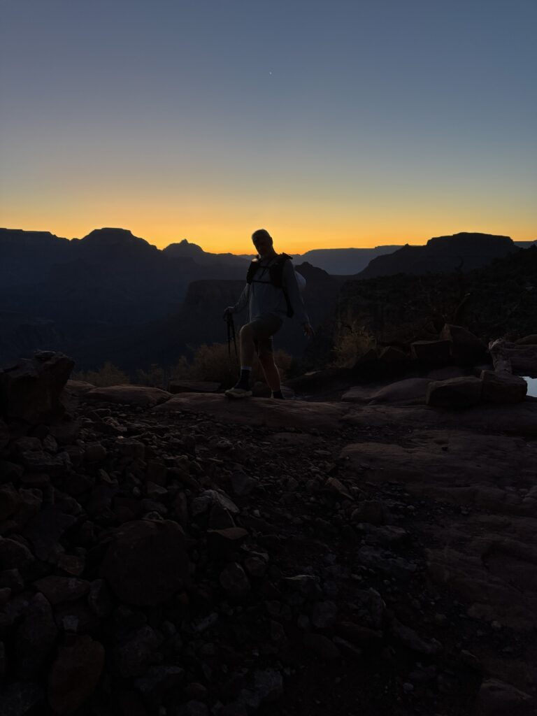
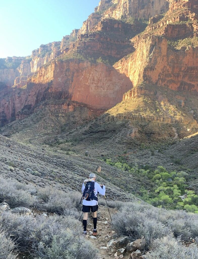
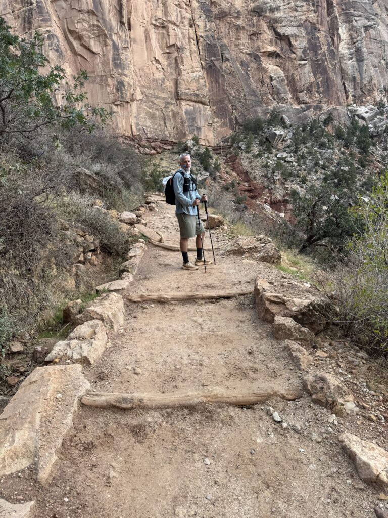
My Garmin says we started at 4:03 am, although it was probably a few minutes lag between hitting the start button and sending the links to everyone. The canopy of stars gobsmacked us, so we stared at them for just a few moments more. All day, we’d remind ourselves to look up from the trail, look around, and appreciate the beauty and ruggedness of the Grand Canyon. Nothing I can write will do it justice. With headlamps on, Mike led us down the dark path, and our Rim to River was officially underway. I had experimented with wearing my headlamp on a night walk near my home, but had never really hiked in the dark with one, and for damned sure not into a canyon, and was happy with Mike as the pathfinder.
I’m also afraid of heights, so when Mike peered over the trail and into the black abyss, I said, “No thanks!” and kept on going. The trail was wide, flat, and not at all hard to walk down. A step down over a wooden beam or stone step now and then. We dodged some recent scat and wondered if there would be animals scaring the scat out of us, but we saw none.
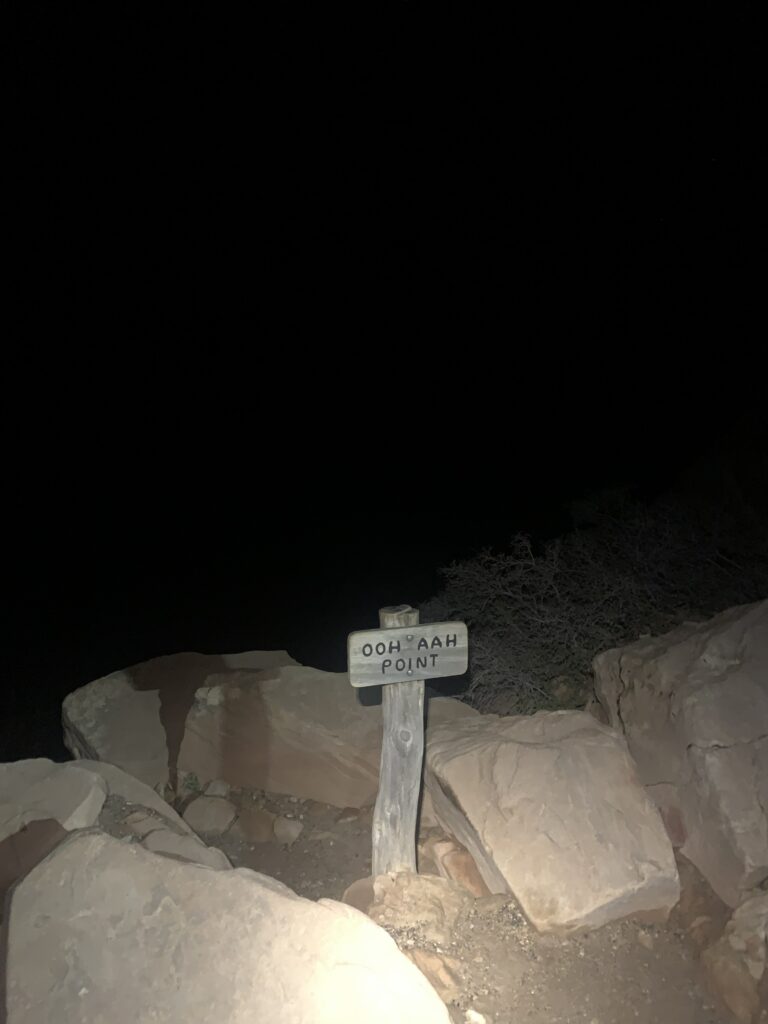
We passed “Ooh Aah Point”, a supposedly scenic overlook about a mile and a half down where folks enjoy sunrise, but it was 4:40 am, and all we saw was darkness — lots of it. The mile after “Ooh Aah” was the steepest descent of the hike — 859 feet down. I learned that later from my Garmin watch, since in the dark it was just…down.
Our goal was to make it all the way to the Colorado River in the best shape we could for the eight-mile climb out later in the day. We had a plan to stop hourly, and my watch was set to alert us to take a short break, drop the pack, eat and drink a little on schedule, stretch, and then resume our hike after 5–10 minutes. We were going to be disciplined. The first time my watch beeped, we dutifully found a flat and wide section and took the prescribed rest break at 5:04 am. (I even took a death-defying pee over the edge, wondering if my ex-hotel coffee would trickle down onto the switchback trail below, and I’d have to walk through that later. Eww.)
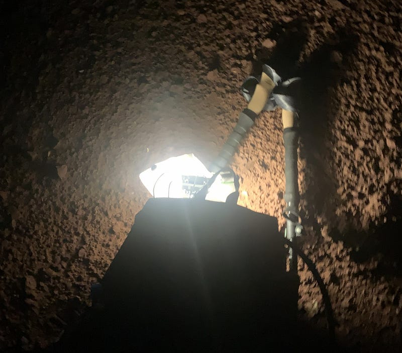
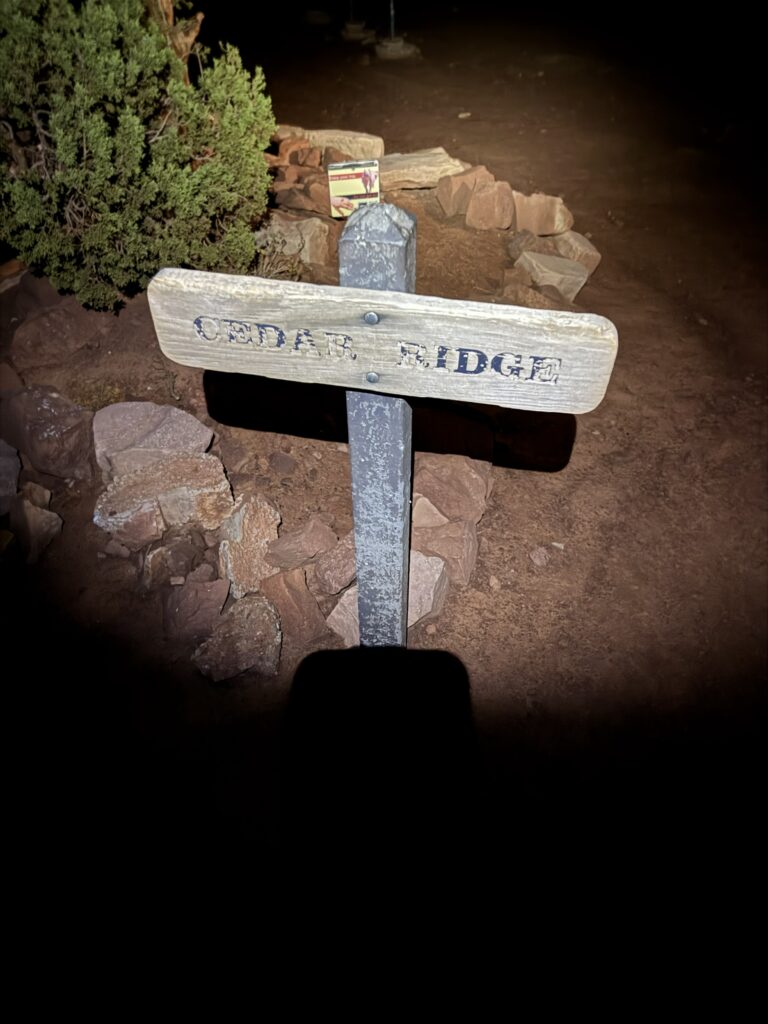
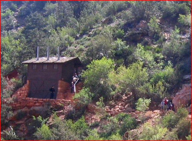
We shouldered our backpacks on time and resumed our hike. Probably after literally no more than 10–20 feet, we rounded a bend….and our headlamps lit up the Cedar Ridge rest area (below), with bathrooms, a place to sit, and far nicer than the standing-up, ad hoc rest area we just left. We laughed so hard at how close we were and had no idea. It was a good time. The first of many.
FIRST LIGHT
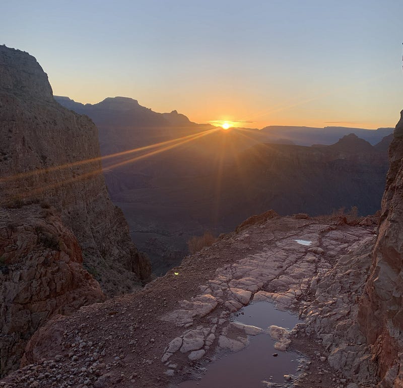
We continued down the trail with no problems, taking a few photos along the way, and soon, in the distance, there was a hint of gray and sunrise just after 5:15 am. Not enough light to ditch the headlamps until just before 6 am. And with that came tradeoffs. No more angst over hiking in the dark, but now I could see the trail downward and the cliffs. The vastness of the Grand Canyon was awe-inspiring and never bothered me. Falling to my death did. But finishing this darkness segment of the hike was an accomplishment and my first milestone. No unexpected problems yet.
Four hikers from Omaha, Nebraska, passed us on the descent about this time, the first of many. I would comment all day long, that while we were not at all lollygagging and hiking quickly was never our goal, we weren’t passing anybody on the trail! And folks who passed us never looked like they were moving briskly either. This went on for hours, although on the journey up from the river, we passed a few. I was more intrigued than bothered by it.
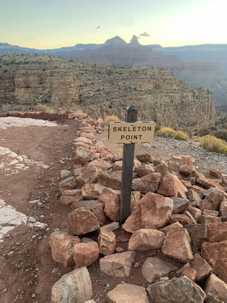
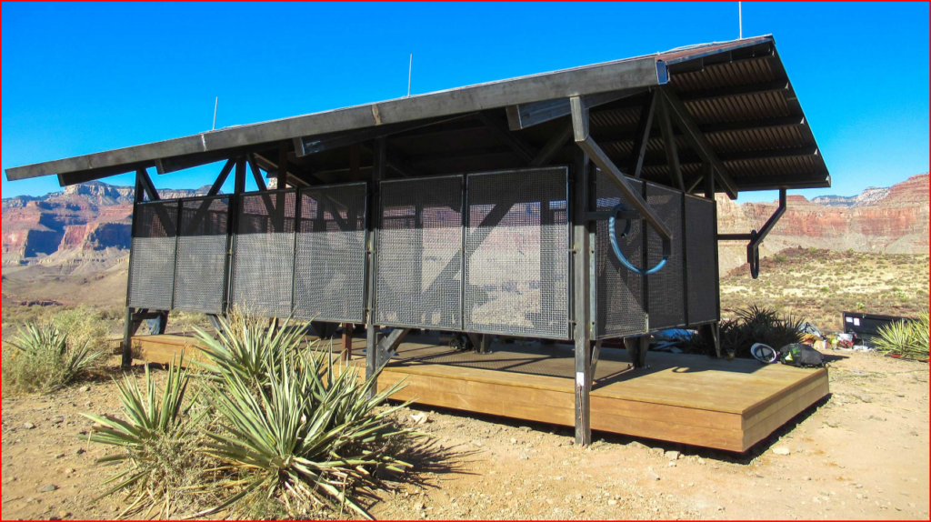
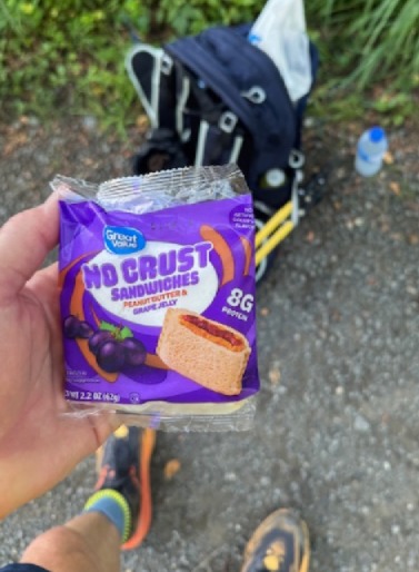
We passed Skeleton Point, about three miles down, at 6:20 am, and by 7:30 am, we were at “The Tipoff”, our second milestone. Tipoff is a real rest stop about 4.5 miles down the South Kaibab Trail, with a small seating pavilion and more toilets. This time, unlike Cedar Ridge, we sat down with packs off. I took in some real food — an “Uncrustable” PB&J, some pickles, and a few swigs of Gatorade. Mike again marveled at how clean the bathrooms were, especially in such a remote location. I enjoyed them, too. Kudos to the park rangers or the contractors who must have come in by helicopter or burro to clean them. We joined Team Omaha in the small pavilion, along with a few other hikers who had started after us. I used satellite messaging on my iPhone to give my wife and kids an update that we had made it this far and to swap some heartwarming, encouraging messages—the best refueling of all.
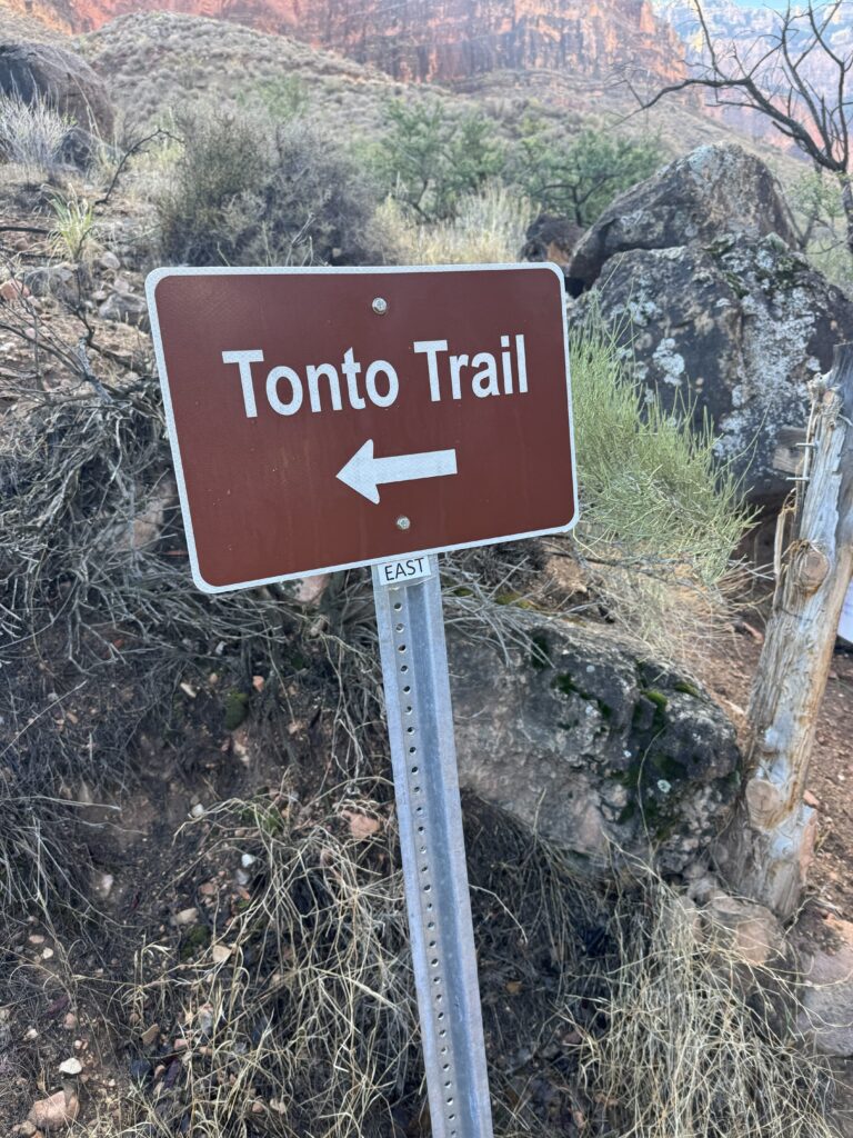
After trading dumb hiking jokes (I offered to trade Mike for one of their teammates — mostly joking), we set off on Tonto Trail, a more obscure east-to-west foot path over easier terrain, undulating with a few ravines along the way. The first runner of the day passed, a young lady we dubbed the “Swedish Nanny” for no good reason other than she looked Scandinavian. We were impressed at how little gear she had and how fast she ran on the trail, and she was running solo. A hiker also passed us, maybe in her 50’s or 60’s (I didn’t ask). We’d meet again later on the Bright Angel Trail, like so many others. We also met a long-distance west-to-east hiker, a middle-aged man on a weeks-long trek along the Arizona Trail — all impressive people. As I had learned from the R2R Facebook page, there’s plenty of hiker traffic out there, and the time between human contact is never really long at all. It was good to confirm that, and we never felt isolated.
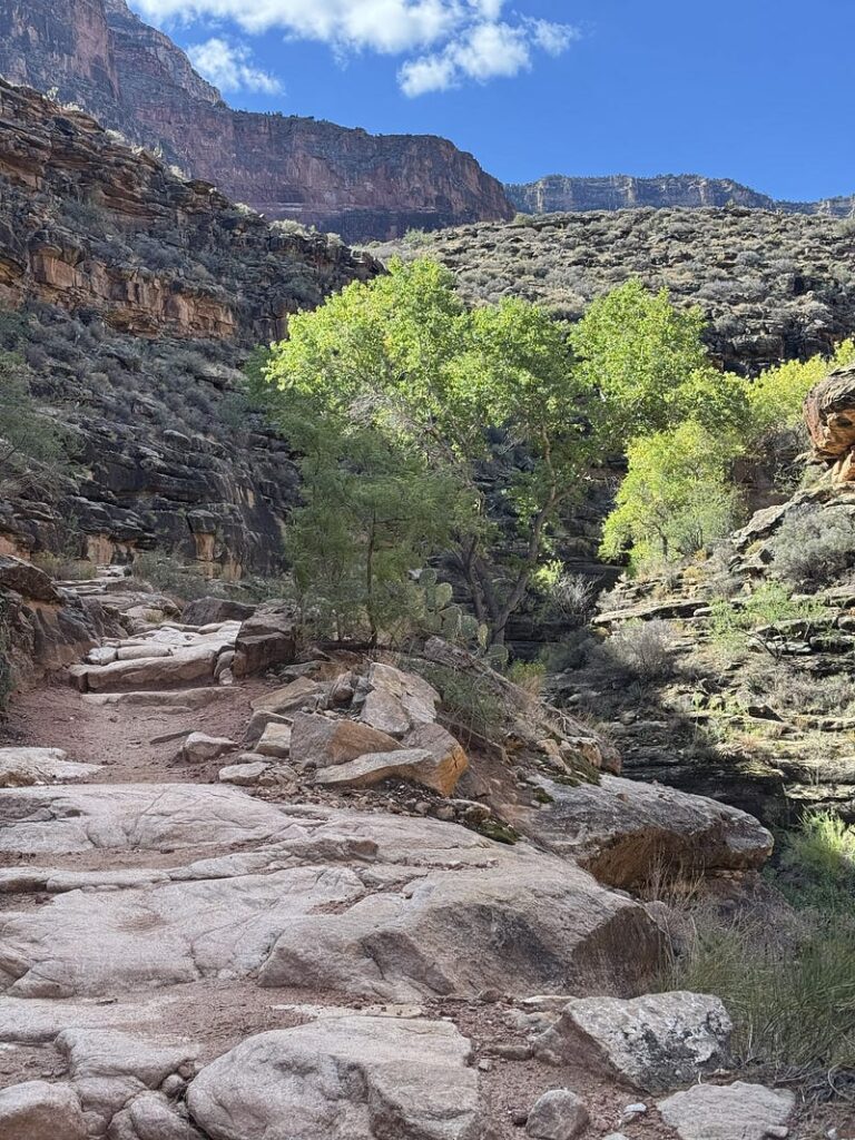
The first part of the Tonto Trail was in the shade, after which we began hiking in the sun, with our hats or hoods on. The tricky part of hiking down South Kaibab and across Tonto is often the relentless sunshine and the lack of water sources the whole 12 miles to the Colorado River. You can head up after nine miles and linking up with the Bright Angel Trail to refill at Havasupai Garden, before backtracking to head down to the river — adding maybe a half mile to the hike up. That was not our plan. We were carrying about three liters of drink each, and with the excellent (cool) weather and less taxing descent, we had plenty. We would first tank up at the creek flowing into the Colorado River later that day.
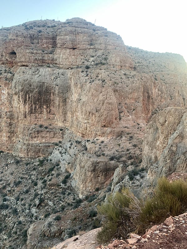
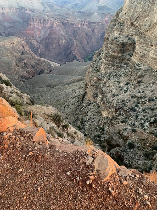
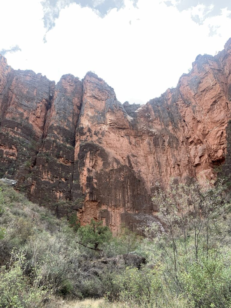
The view descending South Kaibab was majestic, with rugged, striking canyon walls in all directions, miles away, in changing colors as the sun rose, and peering down the switchbacks that brought us to Tipoff Point. Tonto Trail was more expansive, lots of scrub brush and rocks up close, and way in the distance, a glimpse of the construction equipment, possibly upgrading the River Trail along the Colorado River. Helicopters ferrying tourists and construction materials shuttled in the distance, offering some distraction.
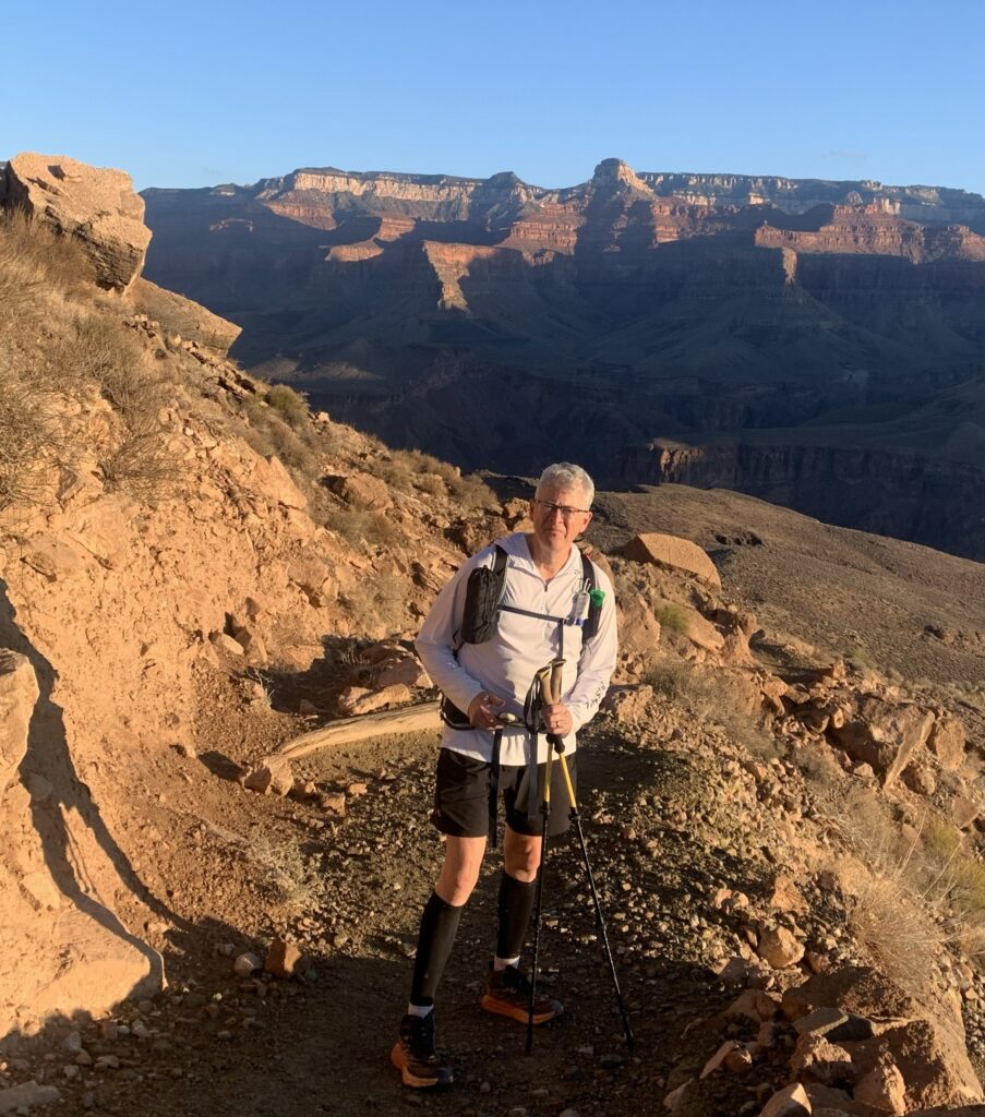
Somewhere along Tonto, I began to tell Mike all systems were go physically, except for a new and unexpected ache — a strain, maybe — in my left hip, running into my thigh in the front. Mike spun around, puzzled, and surprised me with a “Are you kidding?! Did I already tell you and you’re messing with me….?!” Or something like that. He had the same ache, in the same place, coming on at the same time, and neither one of us had felt that in all of our training hikes. It was a little eerie. As with all of our other minor aches and pains, it gets in your head a little — this isn’t bad, and I can manage it, but is this something minor that’s going to turn into something major later? The pain was far less of a problem than the angst.
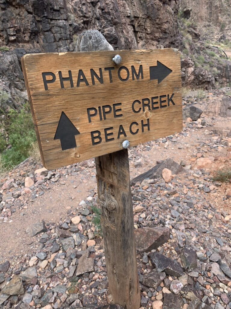
I thought when we reached the Tonto-Bright Angel junction, around the nine-mile mark, our descent was over. Wrong. Mike pointed out that we would be about two-thirds down when we joined Bright Angel, and that it would be another 1,200 feet or so of descent to reach the river. That kept me from getting giddy or overconfident. Stick to the plan. Conserve energy. Get to the river unscathed as best we could.
There was no excuse for my not being aware of when the elevation challenges would change. Mike had put so much work into plotting the course, uploading a custom version onto the Alltrails app and our watches, and we had talked so much about the waypoints along the way. I had a handwritten list of what I thought the major milestones were. Wish I had paid better attention to the elevation on the way down.
OASIS — THE FIRST TIME
The Tonto Trail — Bright Angel Trail junction (our next milestone) is lush along Garden Creek, where many hikers were congregating, sitting on rocks in the shade, and gathering themselves for the next leg up or down. We enjoyed a fair amount of camaraderie again and downed more food and drink to sustain ourselves for the journey to the river. Stretched a little. Took some photos. Tried to send phone messages unsuccessfully. My iPhone satellite messaging couldn’t find the satellites here. We shouldered our packs and began the descent to the River.
It was here that the solo woman hiker (50’s? 60’s?) from Tonto passed us again. She was a little irritated that a woman told her it was not possible to descend to the river — that Bright Angel was closed heading down — and she had started up towards Havasupai Garden before someone else gave her the correct information, and she headed back down. She said the first hiker had been a bit adamant and aggressive on the closure, and she just glared at her. Mike said, “Tell us who it was and we’ll bump her off the trail.” The lady replied, “nah…all good” before hinting at the culprit, “She was in a pink shirt.” We howled. We didn’t push anyone over a cliff. Days later, she posted her Rim to River experience on Facebook, and I’d learn this was Eileen, a woman I had corresponded with on the R2R Facebook page seven months earlier when we were both asking for advice on hiking the Grand Canyon after total knee replacement. I wish I had known that as we passed. She was quite the inspiration.
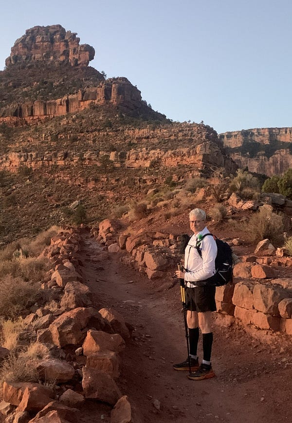
THE DEVIL’S CORKSCREW — WHERE IT GOT SCARY
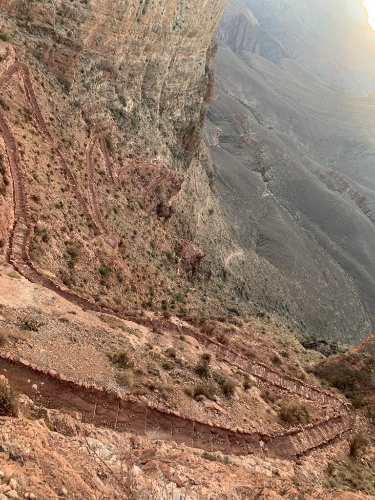
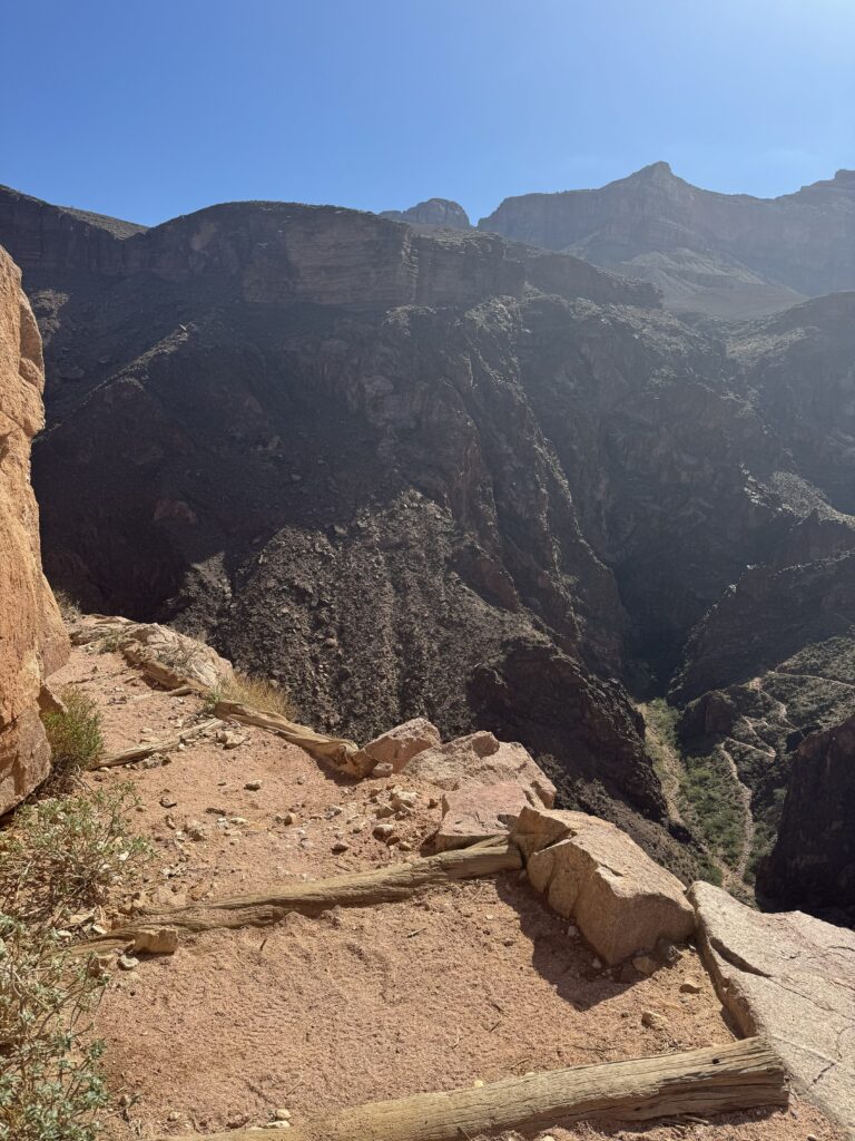
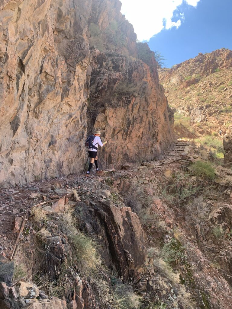
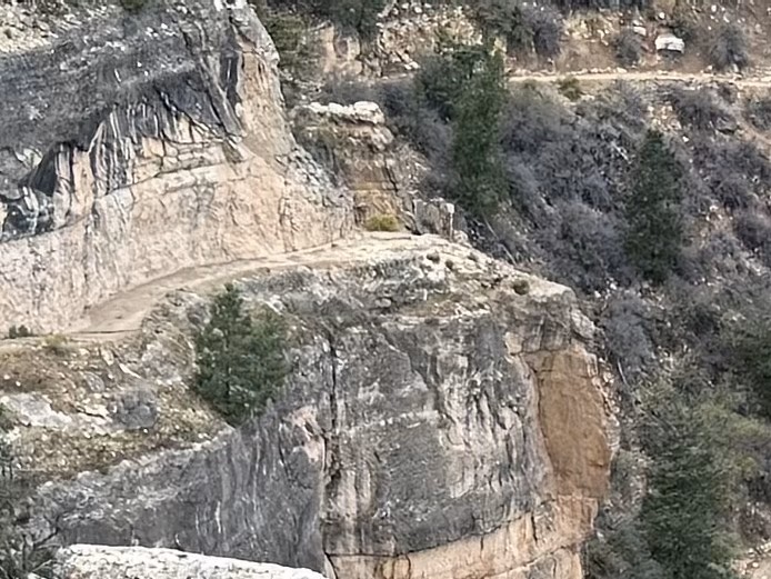
Mike said the next challenge was called the Devil’s Corkscrew, a name I hadn’t paid attention to, and maybe that was best. Devil’s Corkscrew, as I recall it, was the third of four sections down Bright Angel from the Tonto Junction, the first being a not-too-difficult trail with some rocks and ruts along Garden Creek, leaving me with a false sense of comfort that getting to the river will go fine. The second got my attention. The trail was carved out of a canyon wall, maybe eight feet wide, with, I’d say, an easy couple of hundred feet of sheer drop to the bottom without even some small boulders along the edge of the path to keep you honest.
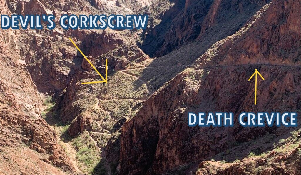
I thought this kind of path was only on the North Kaibab Trail and no longer a threat since we weren’t doing Rim to Rim. Did I mention I hate heights? Months earlier, I had even checked in with a sports psychologist to handle the North Kaibab cliff better when I thought we were doing R2R. I was spending every waking moment wondering how I would get through that section, a real downer during training, and I didn’t want to do that anymore. I also wanted coping techniques to talk myself through that frightening section once I got there. I was relieved to give all that anxiety and countermeasures up when the North Rim closed. And here was an almost identical, dangerous-looking precipice again on the south side. Worse, this section must be done twice, once to get to the river and once to get back up. If it sucked descending, there was no choice on the return.
I wasn’t happy at all and summoned much focus when we hit that section. It’s only a hundred yards long (or 200?). My imagination for months had me picturing an unexpected stumble, an ankle twist, feeling dehydrated and woozy and unstable, and plummeting over the edge to the bottom. Never mind, as far as I can tell, no one ever has. I’d be the first. I zeroed my eyes in on the junction of the canyon wall and the path, reminded myself I was steady and strong, and hummed “Amazing Grace” on my way in. Fascinated with a small length of pipe embedded along the edge, Mike veered that way, wondering what it was for, and I interrupted with, “Not now, Mike. Really?!” He was kind and apologetic, and a few yards later did a minor stumble himself on a rock. Not even close to the edge. He wasn’t fazed at all, but it confirmed to me that it could happen. One stumble sideways……
After I survived my Death Crevice, we officially started down the Devil’s Corkscrew around mile 11, a series of switchbacks tighter, narrower, and steeper than we had done since the first few miles of South Kaibab. I cared not how tricky they were after the stress of the section before, and was trying not to think about having to do the scary part again. The Corkscrew was solidly in the sun. We drank a little more once or twice and looked forward to the break at the river. The descent had more than a few “steps” that had me bracing with my poles before stepping down, and they were sure to be harder coming back up.
The young man we met at the 4:00 am start, who headed down South Kaibab first with his father, was already climbing back up from the river, and we had a nice chat. His father decided to hang out at Havasupai instead of going to the river. The son was having it so easy; he didn’t even filter or refill any water at the river — the weather was a real break for us all. The Swedish Nanny was also running back up from the river — now our “hellos” and her accent now suggesting she was Australian. Close.
THE COLORADO RIVER
Down by the banks of the Colorado
The years flowed softly before my eyes
And the circus joined me in my quest
And stayed with me throughout my test
Down by the banks of the Colorado
There is another Colorado
Wise men have told me, wise women too
That I may find my sweet El Dorado
Down by the banks of one sweet Colorado
– Jimmie Dale Gilmore, “Another Colorado”
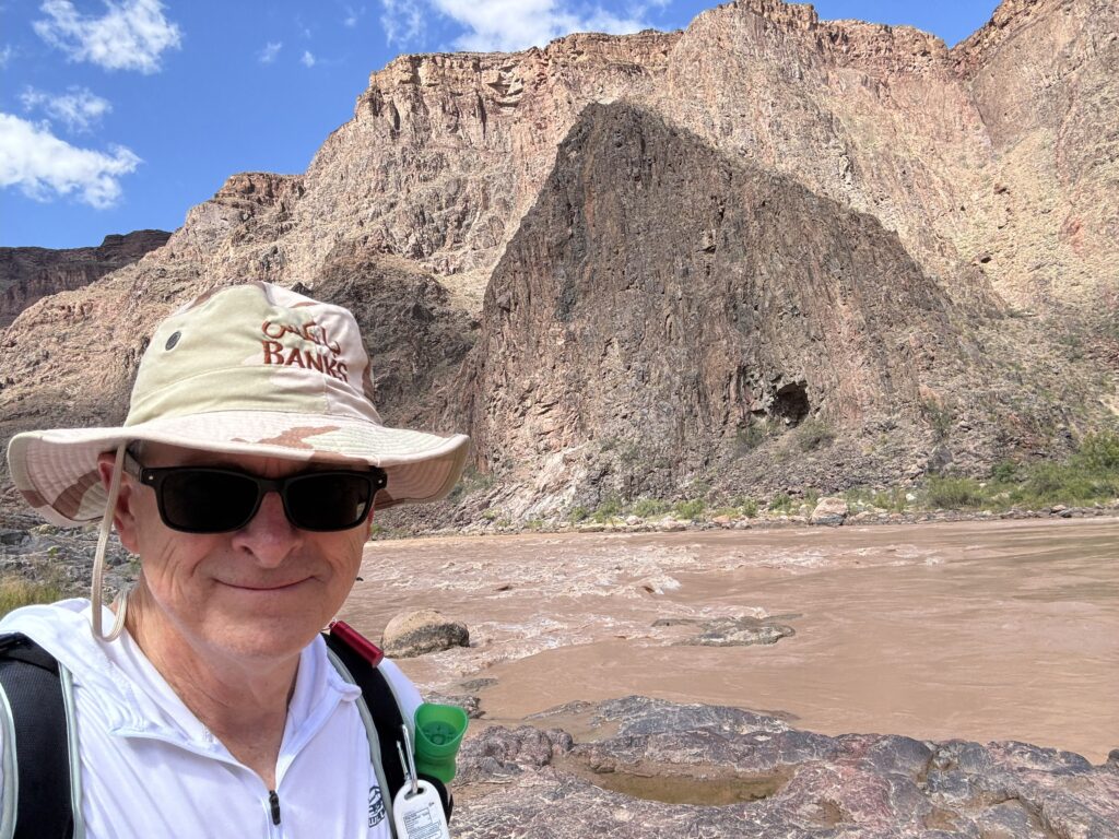
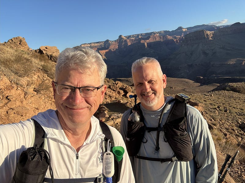
Finally, the Colorado River about 11:30 am. A relief. A big accomplishment. Maybe halfway done the whole hike, not by distance, but mentally. We made it 13+ miles down over about seven hours with nothing untoward happening, feeling a little tired and a little achy, yet in great spirits, knowing we had reached a major milestone in good shape. We weren’t cocky at all, and yet our confidence was growing: while we had the most challenging part yet to come — an eight-mile hike up 4,400 feet (I had paid attention to that!) — we did what we wanted — got to the river healthy and in the best position for the climb out. Quite surprising, we had read for months on the R2R Facebook page how unexpectedly beat up everyone’s quads were after the descent, and neither of us had any undue discomfort at all — tremendous relief at that.
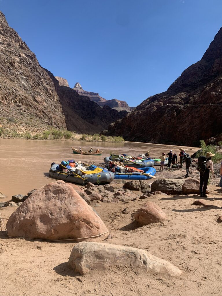
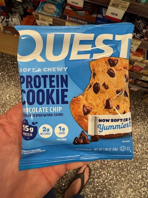
It was pretty crowded at the Colorado. Rafting tours were swapping out groups at the “beachhead,” with quite an accumulation of hikers. Some of the hikers had come the South Kaibab-Tonto route as we did, and some were “just” doing Bright Angel down and back up — a 16-mile descent/ascent in itself. We plopped down in the small shade shack. We did what we said we were going to do: swap out dry socks, apply some Deep Blue rub to sore muscles (I brought a half dozen small sample packs I bought on Amazon — love them), roll a small cork ball under our arches to rejuvenate them a bit, take in some decent food and fuel, and give ourselves a more proper 20–30 minute rest than the few 5–10 minute stops we made coming down. I ate a pair of Uncrustable PB&J’s, a protein-laden chocolate chip cookie, and some more pickles, and drank a good half-liter of water.
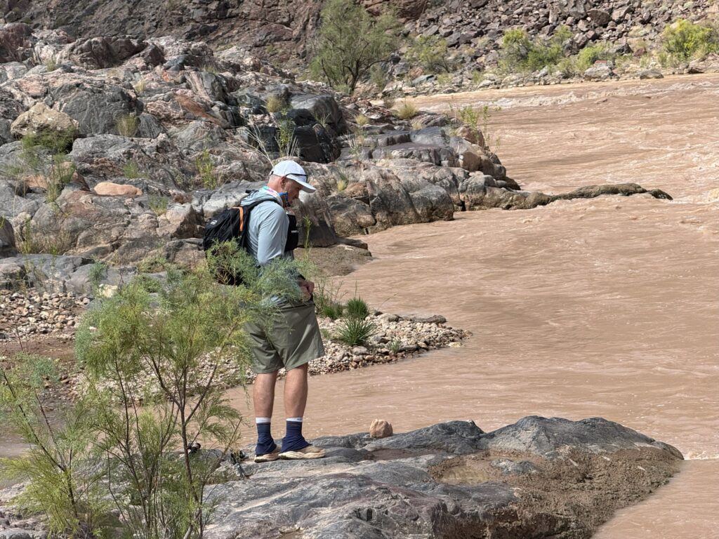
We met a couple from the rafting expedition who asked about the news and college football since they’d been off the grid for a week. One thing led to another, and we learned they live in Sterling, Virginia, minutes from us. Mike and I used to work with their cousins — small world. I snuck back to the bubbling Pipe Creek in front of the shack to filter a liter of water and top off for the ascent. Barefoot. Doing everything I could to not slip on the rocks and fall. Or have my filter top roll into the water as it did on a practice hike (and vanish in the rapids). Rinsed my feet off in the cool water for 30 seconds, then spent five minutes trying to dry them enough to get fresh double-walled socks back on and shoes, but none of them would cooperate. And realizing I was blocking others from getting from the trail over the stream, I retreated to the shack to get my act together, mix some Tailwind electrolyte mix into a liter of water, and move on.
I wish I knew how long we stayed at the river. The mile before the river took 30 minutes, and the mile after only 26, but my usually reliable GPS watch shows a spiderweb of red lines traipsing back and forth from the river to the shack, across the stream bed, and along a whole mile of meandering, and, along with the rest stop, took an hour. Seems long. Who knows? Maybe a 30–45 minute break overall is my best guess.
“ONE OF THESE DAYS, I’M GONNA CLIMB THAT MOUNTAIN. WALK UP THERE AMONG THEM CLOUDS”
(Walter Brennan — ”Old Rivers”)
The climbout begins. The 10 minutes of futzing with my shoes, socks, and water filter at Pipe Creek frustrated me and put me in a foul mood to start our ascent, when I should have been grateful I made it to the Colorado River and replenished in far better shape than I might have been. It took me a bit to shake off all that negativity and enjoy the beginnings of the climb out. But climb out we did.
When I ran marathons, the goal was to get through the first 20 miles unscathed and dig in for the last six. The last six miles of running were always like a totally different event — the same with climbing up and out of the Grand Canyon. The first 13 miles were behind us, and I felt about as good as I did after a seven-hour training hike with Mike. Growing tired but not broken. The serious part of the hike was ahead of us, eight miles and 4,400 feet of elevation or so. So far, nothing had gone wrong, no unforced errors, and nothing unexpected that could have made it even harder than it already was — or worse, nothing catastrophic requiring evacuation. Also, I wasn’t dead.
And we got more serious, too. The sun was on us all the way up Devil’s Corkscrew, and on came the hats or hoods, as we pushed upwards and onwards, leveraging our trekking poles more and more. We ascended steadily, climbing “steps” that were sometimes over four-inch beams, and sometimes maybe a foot high. Off and on, the trail was rocky and uneven. Switchbacks, a short straightaway, and more switchbacks. It would be that way for hours, for miles, until we (hopefully) finished at the Bright Angel Trailhead.
This was the same section of the trail we had come down an hour or two earlier, and yet climbing was, of course, more work than descending. Yeah, going downhill and braking your steps tires the legs, but the lungs get a pass. Going up lungs and legs pitched in equally. My witty banter got less. Mike was probably relieved. We paused for a swig of water and a 30-second breather here and there, but no real breaks. It was also much on my mind that I had to navigate the Death Crevice again, and I just couldn’t relax mentally until that was done.
Oddly, when we finished the Corkscrew and headed into my deadly nemesis drop-off section, I said, “This can’t be it? I don’t think we’re at that point yet,” to Mike, who, unbeknownst to me, was recording it on his phone, risking his own plummet to the death. It just didn’t look the same. Maybe I was getting used to it or losing my mind, but before I knew it, we were through it and back at the Garden Creek overlook. Yes, I was relieved. All I had to do now was keep climbing, keep breathing, and keep refueling. How hard could that be?
OASIS — THE REUNION (Not the band)
Steady. Keep moving forward. Soon, we were back at the Bright Angel-Tonto intersection oasis, with shade, big rocks to sit on, and our first short break since we left the Colorado River: about 15.75 miles and nine hours since we headed down South Kaibab in the dark. We were only loosely following the game plan to take hourly breaks now. We took breaks when it made sense. And it made sense now to regroup just a little and plan the rest of our hike out. The next proper stop was Havasupai Gardens, maybe a third of a mile up the way, and where there would be a water spigot to refill our water bottles. Then we had maybe three 1.5-mile chunks left: Three Mile Rest House, 1.5 Mile Rest House, and…THE FINISH! Never mind it was about a 2,000-foot climb to Three Mile Rest House, another thousand feet up to the 1.5 shelter, and another 1,200 to the finish — unless the wheels came off — and that could still happen — we allowed ourselves to entertain the notion we were probably going to successfully do this hike.
We saddled up and marched to Havasupai. Ten hours and maybe 16.5 miles behind us. It was shady and crowded, and the resting hiker crowd watched me try to refill my water bottle, only to have the high-pressure spigot blow it out of my hand to roll across the ground. A young lady said not to worry — everybody did that. Kind, and I didn’t believe her. (Days later, I would read on Facebook that yes, it was high pressure and more than a few water bottles got launched here. It wasn’t my fault!)
Mike and I retreated to a small pavilion to sit, drop our packs, eat a little, and refuel. He lay down on the bench and regretted it almost immediately. Painful to uncurl back up. I ate the almost-cold slice of pizza leftover from dinner the night before, and it was so good. So many hikers from the R2R Facebook group said they craved real food late in the hike, and they were right. Pizza was satisfying. So were the text messages I exchanged with my wife, as she encouraged me on. I welcomed that. Packs back on. Three miles to go.
We were consistent and steady in our pace, and getting tired for sure. Calves were tight, and I wondered what it would be like to strain or rip one, and tried not to favor one leg or the other on the step-ups. Rainwater had puddled days earlier in the divots in front of the wooden retaining beams at the steps, and I once stomped right in the puddle when, in midair, I realized my stride was too tired to veer right or left. Mike wondered if I was getting woozy-headed, and I said no — I just gave up trying to maneuver around the puddle, grateful for my Hoka Speedgoat Gore-Tex shoes. That became more dicey after I noticed some of the inch-deep puddles were not muddy at all, and you could actually see the bottom. Those were puddles of mule piss. Yuck. I found new energy to step around them. Gore-Tex isn’t foolproof.
The path from Havasupai Gardens to Three Mile Rest House is panoramic in the mid-afternoon colors, with the trail sweeping in broad arcs and the switchbacks upon us only in the last quarter mile approaching the stop. Oh, it was still hard, and we were a little winded, tired, and sore, but with growing confidence , two more stops to go.
THREE MILE REST HOUSE
After about 11 hours and 18 miles of hiking, we reached the Three Mile Guest Rest House. Okay, they’re really called rest houses, not guest houses, and I made that mistake over and over again to Mike’s amusement. Not many people in the small pavilion. A young couple joined us, and a couple of quirky teenage boys who had just walked down from the Bright Angel trailhead. We sat, packs off, and had another round of drinks, pickles, and my second pack of Pop-Tarts. There was a water spigot behind the shack, but we hadn’t drunk much since Havasupai, and there would be one more spigot at the 1.5 Mile Guest Rest House, so we skipped refilling. Even after I clumsily knocked my water bottle off the bench onto the floor not once but twice, I still had plenty of drink. Packs back on, upward we went toward the next and final rest stop. Mentally, the growing confidence offset the weariness. As with every stop, the first dozen steps after a break make all the bones creak and rattle as we stiffly try to regain some momentum.
Stride, stride, step up. Stride, stride, stride, step up. Pause for a drink, but no real break. We had a great rhythm going. When we did a training hike in the White Oak Canyon in the Shenandoahs back home in Virginia over the summer, a 2,700-foot descent and back up over almost eight hours in the July heat and humidity, I hit the metaphoric “wall” on the way back up—spent and bent over. Head propped up on my trekking poles. Finding some determination and wind to climb another 25 yards, break, and do it again until we were out. It got done that July day, and until we got past the Three Mile Rest House, that’s what I always expected would happen somewhere hiking out of the Grand Canyon and what I had been mentally preparing to manage when it came. It was here that I allowed myself to think we had done so well today, it wasn’t going to happen. Again, not that we weren’t tired, but the bent-over exhaustion and 25 yards at a time survival hike wasn’t happening on our Rim to River hike. Relief.
1.5 MILE REST HOUSE
I’m guessing about 19 ½ miles and 12 hours in, we again dropped packs and plopped down on a retaining wall at the very welcome 1.5 Mile Rest House — our last official break of this epic hike. Here’s how tired we were. There are maybe a dozen steps up from the trail to the little rest pavilion. We looked at them, then at each other, and pretty much said at the same time, no way were we trudging up those steps. Saving every ounce of energy for the final push. We even eyeballed the water spigot on our approach, which was 15 feet closer than the wall where we would sit, calculating whether we had the energy to tank up our water bottles before sitting down, or sit for a break and double back those 15 feet to fill up. Those are the thoughts that go through your head when your legs are turning to lead. Fifteen extra feet, or fifteen extra steps, are longer and higher after a dozen hours of hiking in the Grand Canyon.
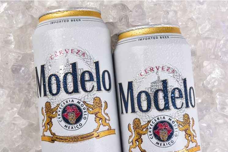
We sat down and chuckled at the crazy design that had steps going up to the rest house. Once again, we passed on the public restrooms as too hard to reach and pretty much unnecessary. I peed at TipOff Point some eight or nine hours ago, and skipped the ones at the river and Havasupai Gardens. No need for any other details. It was a relief (ha!) to know there are public restrooms along the way. Did I mention they were clean? Ate my final pickle, drank a bunch of Tailwind, and refilled only my 24-ounce CamelBak bottle — no need to fill and carry more weight in my two (now-empty) one-liter bottles at this point. Our next stop would be Maswik Lodge, our Juniper hotel room, and a twelve-pack of Modelo Light beers in the fridge. Oh, happy day!
Taking another physical inventory of our bodies while sitting on the wall and snacking, we noted nothing unusual or unexpected – just the aches and pains of hiking from 4 am to 4 pm, so far. Running marathons taught me the difference between the gradual physical and mental deterioration to misery, a positive outcome for me in endurance events, and pretty much the best I had hoped for, and a second-best outcome of “hitting the wall”, which is what happened to me in the Shenandoah hike mentioned above. The worst case, what Mike and I referred to all year as “the wheels coming off” — something awful like an ankle sprain, hip joint seizure, dehydration, kidney failure, falling off a cliff, or any number of catastrophes I could imagine. Unlike marathons, death made the list.
For months, and all day during the Rim to River hike, I was on the lookout for any sign that what was until then a pretty positive hike was going to go bad, and here we were, only a mile and a half from the top, and none of these things materialized. All day long, I tried not to think about how well it was going and jinx the hike. I can be a glass-half-broken guy, so overconfidence does not come easily. So it was at the 1.5 Mile Rest House where I reminded myself that tragically, I think the week the R2R season unofficially opened in May 2025, a gentleman only a few years older than me and by far a more seasoned hiker, died of cardiac arrest only a mile and a half from the North Kaibab rim and a successful finish. I tried not to let this discourage the growing sense of “We actually got this!” and yet it was in the back of my head a little.
ARE WE GOING TO FINISH THIS HIKE OUT TODAY?
Packs on, sticks at the ready, we resumed our hike a little giddy, despite my heart attack phobia. I think it was about here I spotted the American flag flying way up high to our left on the south rim, which I’d later learn was between the Grand Canyon Visitor Center and Kachina Lodge. Once again, I was flummoxed by how little distance we had to travel — a mile and a half — and by how much elevation there still seemed to be (about 1,200 feet!). All I could see were steep canyon walls with no visible way out. Of course, there was a way out, and we’d see hikers way up above on switchbacks, and yet I couldn’t reconcile it all. A mile and a half used to mean 15 minutes of running, maybe 25–30 minutes of hiking. This was going to take longer.
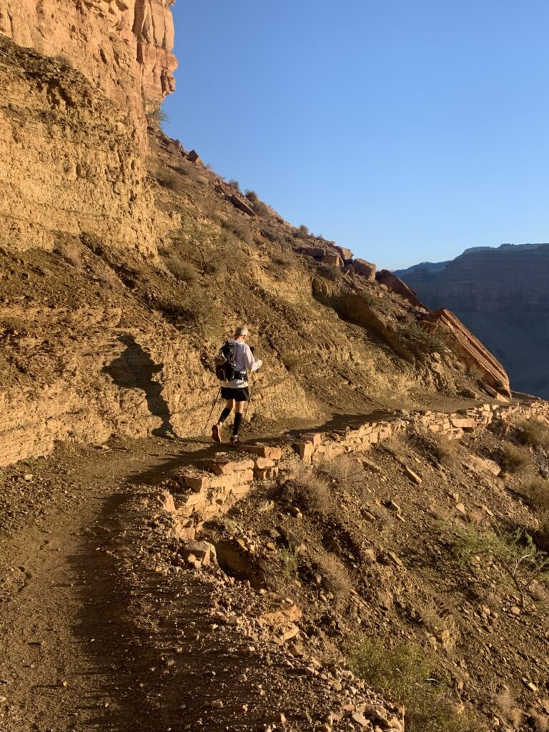
It was also here that the runner dude in a hydration vest we’d seen heading up Bright Angel once before went running back down past us, only to double back as a woman above shouted, “WATER! WATER!” Turns out he forgot his water bottles at the top, and she had trotted down after him with them. What a lovely lady. We asked him about his plan, and he was actually running to the river a second time — 32 miles total down and up Bright Angel. Incredible athlete. Totally insane. Later, Mike told me he thought the lady was yelling for water because there was an emergency, and if someone’s life depended on us running up to her, they were doomed. He wasn’t wrong.
And so up we went. Switchbacks. More switchbacks. Climbing 500 feet in maybe a third of a mile. Some awesome sunlight and shadows far in the distance towards the river as the sun edged west. Incredible views of the Bright Angel path worming up from the Havasupai Gardens. I stopped thinking about a heart attack and focused on keeping my form — this was no time to stumble — and climbing out. When I sometimes did trail running back in the day, I only tripped and fell once the path was smooth and free of rocks and roots. I’d get lazy and drag my feet. Lose my concentration. Couldn’t do that here. Mike and I had a steady rhythm going, knocking out far more distance than we thought we would in between a few short stops to catch our breath and sip some water. Somehow, it’s entirely possible to feel near exhaustion and incredibly strong on those final switchbacks. It’s all in the head. And the legs. Oh yeah, and in the lungs.
THE END IS (ALMOST) NEAR
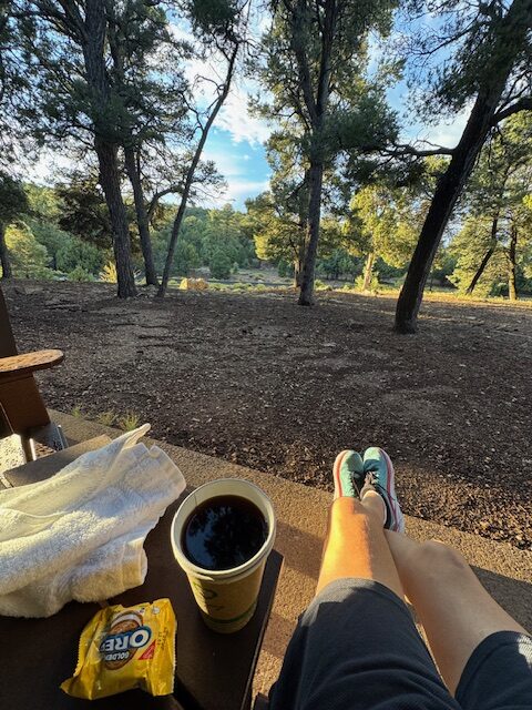
After a half-mile, the switchbacks end, and we begin a long, sweeping arc, with the final ridge in sight, way to our left, where the Grand Canyon rim trail and the Bright Angel Trailhead meet. It’s possible to see tourists perched up there, if I remember right. The day before, I was one of the tourists up there watching hikers making their way around the bend. Enjoying a cup of coffee and pondering what it would be like to be rounding that bend myself, hopefully successfully making my way out of the canyon — only another 600 feet of elevation to the finish, with a mile of hiking to go. I wondered how I would feel. Now I knew. Now we were the hikers others would be watching.
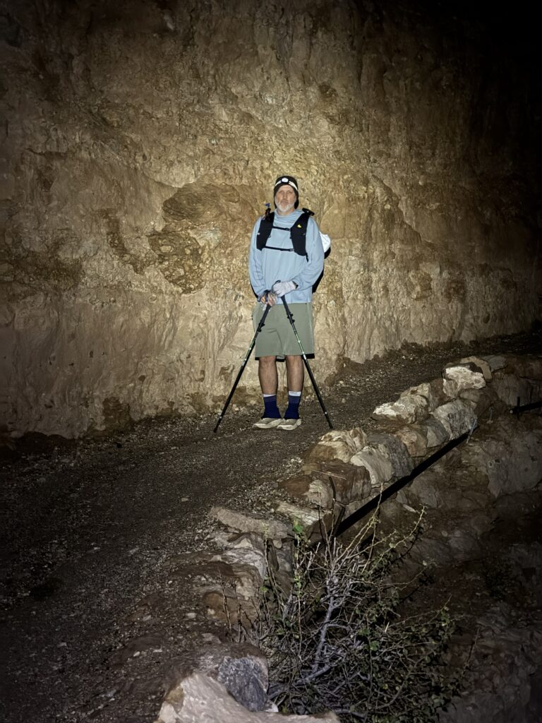
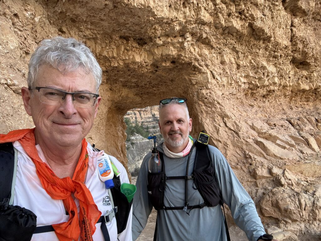
We thread the lower tunnel, and before reaching the upper tunnel, there’s a mom with maybe a six-year-old boy hopping around on the rocks, and I’m thinking, “No way I’d have a toddler anywhere near this trail!” Not that I raised my kids to be neurotic like me. This section of Bright Angel is easily accessible for folks who want to descend a bit from the trailhead for some cool pictures and just a little of the trail experience, I think. Rounding the bend towards the upper tunnel, our last little milestone, the trail is once again perilous to me — maybe eight to ten feet wide with no border, and straight down, I don’t know, a hundred feet? I don’t need this so close to the end. A young man is coming down the trail, pauses to take pictures near the edge, and I am walking behind him. I think “How brave. How foolish?” and my neurotic brain says no way would I get close to the edge and turn my back on a stranger. I’ve seen too much craziness on TV.
THE END IS REALLY, REALLY NEAR!
We reach the famous upper tunnel and stop for selfies. We know we got this, and we allow ourselves to fully acknowledge it. The legs are heavy, the shoulders sore from our packs, but it’s relatively flat here, and though weary, we are excited. All the work and miles we put in over the months were worth it — our obsession with the logistics and planning paid off. All of the things I lost sleep over, and most of the trail, were behind me. How scary would it be to hike in the dark and cold by headlamp at the start? Would I stumble and fall off a cliff? How hard would it be if the heat were unbearable? What if we ran out of drinks? Twist an ankle? Just plain old exhausted, and we have to overnight to recover before hiking out? Massive cardiac? I had run through all of these in my mind over months and months, and had mitigation plans for them, too. None of the catastrophes happened. Uncertainty answered. Just a proud, earned exhaustion.
THE END
One final path heading northwest, a switchback to the southeast….a gentle incline, and WE ARE DONE!! We gather at the Bright Angel Trailhead to take a photo to bookend the one we took just over 13 hours ago, in the dark, at the South Kaibab Trailhead. A wonderful young lady, hanging out with her son, offers to take the picture for us, and we accept. She takes a few, holding the camera up high so “we don’t get any double-chins in the picture.” Slightly offended. Too tired to object.
Mike and I shake hands and congratulate each other. Although we had imagined on all those training hikes that a successful Grand Canyon Rim to River finish would be an emotional moment, probably tears, especially with me coming back from total knee replacement just over nine months before, we weren’t bubbly or exhilarated at all. Pleased, absolutely. Content. I know we both enjoyed a tremendous sense of accomplishment, a little proud and a little relieved that our hike went about as well as it could have gone, and we were done. We sent off some quick texts to friends and family to let them know we were successfully out and the big hike was over.
We shouldered our packs one last time, collapsed and palmed our trekking poles — they had admirably done their job for the day — and headed up the street, a broad and flat quarter mile, to our rooms in Juniper by Maswik lodge. Pleasantly surprised our tanks weren’t empty — yes, badly depleted — but not on fumes. No kidding, if we had to, we could have hiked another two or three miles up and out of the canyon. Not bragging or cocky — that’s where we were. We also agreed that any more than that, and it would have been truly awful — lots of sit-down breaks, refueling, hiking 10 yards at a time, and hoping my joints don’t freeze up. How all year I had envisioned the hike would be near the end. So pleased it was not.
Closing Thoughts
The Rim to River hike took Mike and me 13 hours to complete. Writing this piece is taking far longer. Maybe 13 weeks. The Grand Canyon looks different from every angle – from the rim over coffee the day before, the switchbacks heading down, looking back up from the Colorado River, on the climb out, and on tired legs over coffee the day after. It looks different in the early morning light, the bright sun, under clouds, and when the day fades. It looks different when you’re in it, fresh or tired, anxious or confident. And every time I sit down to write a couple of paragraphs about this magnificent experience with my friend Mike, or take stock of the accomplishment as a guy making the shift from runner to hiker, from middle-aged to middle old, the story and the scenery in my mind change, too. And I rewrite the story.
Some photographs are for sure no longer in chronological order, as I forget exactly where along the trail they were taken. I wasted time trying to get them right before realizing it doesn’t matter. I wanted to capture the flavor, the colors, and the memories of hiking to the Colorado River and back. I indulged myself in remembering when I could run 26.2 miles or run/walk a 50-mile ultramarathon. And made myself sad, remembering before knee replacement surgery when I struggled to walk a few blocks in pain. And feeling proud of the long path from using a walker to get to the refrigerator to training to hiking the Grand Canyon.
Like marathons, this hike resurrected the satisfaction of setting a goal that’s months away, but you cannot put off preparation. Then the morning arrives when there’s nothing more you can do. The taxi’s waiting, he’s blowing his horn. Already I’m so lonesome I could die. You’re ready, or you’re not. And saying to yourself, “I got this. It’s showtime.”
“I’ve got a long way to go before I get there
I’ve got a lot of field to hoe with the sun so high
Got a lot of miles to roll
And the next few only show
That there’s still such a long way to go.” – Dwight Yoakam
Then you plunge into the experience. Hiking to the Colorado River and back in a day was not unlike some personal and professional times in my life, where, try as you might, it takes some work to appreciate you’re in the middle of something personal and special, when you’re smack dab in it, but exhausted. And there’s still a long way to go. Perhaps my career. Or fatherhood. Wonderful journeys, and wishing I could have been more in the moment. With the Grand Canyon, maybe I can go back and absorb it all again without wondering how it will turn out. Maybe I’ll take the kids.
EPILOGUE
The Afterparty and Review
Celebration
Back at the hotel, we split up to shower and regroup in a few for a celebratory beer. And sitting on my bed, unlike the short sit-down breaks at the rest houses, the wave of depletion was almost overwhelming. Out of nowhere, I was choking back some tears for only a moment, tears of relief and joy, really. Emotions were raw after all. The sensation of months of preparation, and in a day, a tremendous feeling of “Did I just do that?” Yes, we did.
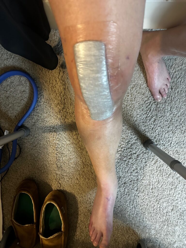
Oddly, fully bending my replaced knee sent tiny, electrically charged sparks all over the joint, almost like little crystals shattering. It wasn’t painful, but it did get my attention. I still don’t know what the hell that was, but I do know this — my mechanical replacement knee, installed just over nine months earlier, worked like a charm. It was never a factor over the 21 miles and descending/ascending the Grand Canyon. I am blessed.
My shoulders groaned from enduring the pack. My calves were tight, and I couldn’t bend my feet enough to take off the calf sleeves I wore all day. Thought I was going to have to cut them off. My iliotibial bands and thighs felt like a baseball bat had pummeled them. All of this was familiar, the same after completing a few ultramarathons, and I savored the earned misery. I drank a cold bottle of chocolate milk, my recovery drink of choice, and chugged a giant, satisfying bottle of ice-cold water. The next test was a hot shower. Back in my running days, the post-marathon shower was where you got the excruciating surprise of identifying raw chafing in peculiar, personal areas. There were none! The day was getting better and better.
I put on some clean sweats, knocked and entered Mike’s room, where we enjoyed some cold Modelo beers, some crackers and Slim Jims that went with me untouched into the Canyon and back, and we watched Monday Night Football and talked about our accomplishment for a couple of hours more. Just like that, all of the obsession with hiking the Grand Canyon Rim to River was behind us, and we could enjoy hanging out in Arizona for another day or two before flying home to who knows what’s next. I am so proud of what we did, both the months of dedication to train well and the completion of the Rim to River hike itself. We did good. Really good.
Assessment – How Did We Do?
Okay, it didn’t end with a twelve-pack of beers and Monday Night Football and Slim Jims, although that would be okay. For the next few days and weeks, we revisited the hike (over more beers), and I thought much about what went right, what didn’t, and what I would recommend to hikers in my place in life, interested in doing a Grand Canyon hike. Here’s what I got.
WHAT WENT RIGHT
Get a Mike. The best thing I did was pick a hiking buddy who was more fit, healthier, younger, more experienced at hiking and gear, more positive, and as determined as I was to complete this hike. It helps if he is a lunatic who can be funny and talk (and listen) for hours on end. My lifelong friend Mike is all that. We booked this as a Rim-to-Rim hike long ago, pending my recovery from a total knee replacement in December 2024. Mike picked me up from physical therapy, did short recovery walks in winter, and introduced me to hiking in the spring. He’s been a hiker for years. He taught me about gear and technique, and led me on increasingly more difficult and challenging training hikes through the summer. Years ago, when I had to give up running, I concocted a solo Rim-to-Rim hiking plan before I ever knew Mike was interested in doing it too. I cannot imagine how I would have done it without him now. Find yourself a Mike to hike. Or be the Mike to someone else.
Arrange for perfect weather. It’s that simple! All year, we assumed we would have to deal with intense heat and unbearable sun while hiking through “The Box,” the toughest section between the two rims, and we trained accordingly. We weren’t looking forward to it, but we were prepared to endure and persevere. Be smart and responsible. Find shade. Refuel. Grind it out. We deliberately trained in oppressively high humidity and bright sun, and also prepared for cold, rain, and darkness. We lucked out with perfect weather, maybe 10–15 degrees cooler than usual. The weather was a total non-factor on our hike. And if we had to do it again, (and a couple of months later, I am oddly allowing myself to entertain an R2R if the North Rim opens in the next year or two!), I would do everything possible to avoid hiking it in unreasonable and unhealthy heat — I would park my butt in the Maswik Lodge for days and days if need be, awaiting a fabulous day. It’s that much of a game-changer.
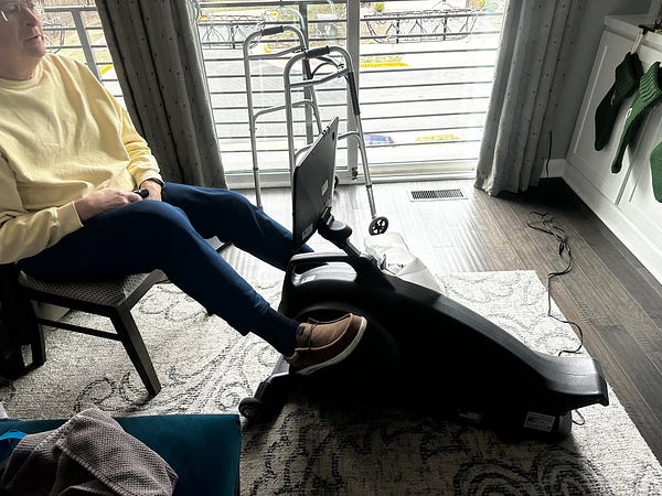
Train reasonably and consistently. Years of marathon running taught me to train hard and well, and to be careful about social media mythology. Some folks are adamant that you need to train all day, every day, to do something like a Grand Canyon hike and are quite critical if they think you’re not training enough (meaning like they do). Others (usually younger and fitter) are comfortable just winging it. For damned sure, you don’t want to overestimate your fitness or preparation and wander down into the canyon to distress or rescue. But be careful who you listen to, including me. I believe in training responsibly and recognizing that a good enough plan and sound logistics, coupled with determination and mental toughness, will see me through an endurance event. I will say that if you train harder or better than me, you will probably hike better than me. My plan was good enough for me to be successful.
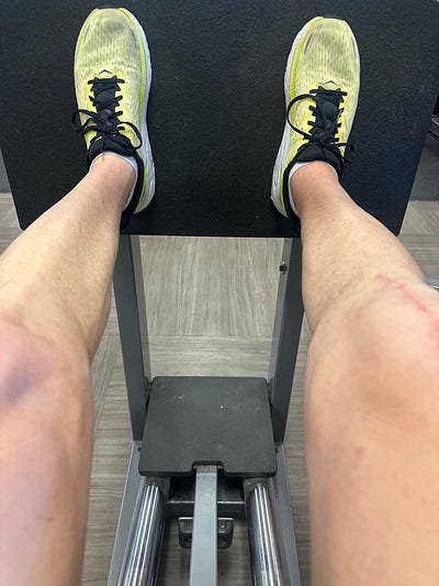
My physical therapist had me on a good regimen, not just for the knee but also for my core, balance, and strength work in the gym three times a week, maybe an hour at a time. Every other day, I did the Stairmaster in some form: three to five sets of 5 minutes each, with 90-second breaks. Eventually got that up to 20 minutes nonstop. Once a week, I’d walk backward for 30–45 minutes on an inclined treadmill to beef up the quads, as I had learned from the Facebook R2R group. I found the backwards treadmill thing to be a chore — it takes a lot longer to get the legs burning than the Stairmaster, and it was boring without a TV monitor to watch, and now I was staring at all the people on cardio machines, staring back at me. I didn’t do this as much as I should have. That said, as I mentioned when we hit bottom (of the Canyon, not physically or mentally) I felt no pain at all in the quads, even though I didn’t work on them as hard as I had hoped.
Based on Mike’s recommendation, I bought a 20-pound vest, and when time was short, rucked walks and hikes, and even some hills to maximize training when I could. I took it on vacation with my wife, and we walked in parks and botanical gardens. I thought I looked like an elderly SWAT team guy. I think it helped, and I hope to never wear it again. It sits in my garage. Make me an offer.
And of course, we hiked. I think we did nine increasingly more difficult training hikes culminating in a 16-mile, 4,600-foot elevation hike in Harpers Ferry, West Virginia, three weeks before the Rim to River. Four times up Maryland Heights, a thousand feet climb over two miles, in the heat (and back down, of course). We also knocked out a 21-mile “walk” in 90+ degrees and high humidity, in July, to get time on our feet and more experience with hydration strategies.
Terribly important was the brutal (for me) hike down into the White Oak Canyon in the Shenandoah Mountains in oppressive heat and humidity. I firmly believed, as with running marathons and a few ultras, that the success of the Grand Canyon Rim to River hike would be decided when I hit rock bottom physically, with lungs and legs on fire, exhausted, with nothing in the tank, discouraged, and wondering what on earth I’ve gotten myself into. The critical time when you’re in the miserable “here and now” of finding a way to replenish energy stores and summon the determination to finish. I have been there. I have never quit a marathon or ultra. I wanted to experience that bottoming out in training again as a hiker to build more confidence that I could do it in the canyon. And White Oak did that to me. For me. You can always train more, and yet Mike and I were comfortable that we had trained well enough to grit out the Grand Canyon hike. If we failed, it would not be because we took this lightly or were irresponsible in our training.
ROAD TRIPS. We refused to let training and long hikes become a chore. We repeated some challenging local hikes, and I depended on Mike to identify distant ones that would push us – and also provide an excuse to road trip, hike hard, and lay up in a hotel and drink beer. Some of that was practical – who wants to drive before sunrise, hike eight hours, and drive long hours to get home? And not enjoy beers? Not us. We even capped a few all-day local hikes with a cooler of refreshing cold onesand camp chairs, even though we were close to home. The goal was productive training and a damned good time. We succeeded at both. The whole journey and not just the destination thing.
FUEL CHOICES. Here’s a link to a separate piece on what I chose to eat and drink on the Rim to River and why, as well as gear that worked (or didn’t), and for now, I’ll just try to describe our approach to refueling for context. Endurance athletes are well aware of the need to refuel before they’re hungry or thirsty, and keep topping up the tank throughout the day, and Mike and I had similar menus and schedules for replenishing energy. We talked about refueling options almost as a hobby for months leading up to the Rim to River, and tried out an assortment of food, drink, and snacks to learn what would work and what we would like.
My plan was to eat something simple, small, and quick – like an energy gel or handful of pretzels – hourly, and down something more substantial at longer breaks every three to four hours. I’d say I largely stuck to that.
We learned a great deal from the experiences shared in the Facebook Grand Canyon groups. For example, it was driven home that as the day grinds on, hikers lose interest in many of their food choices, and refueling becomes a matter of what you can still tolerate or get down when nothing in your pack seems appealing anymore. Because of that guidance, we paid particular attention during training hikes to what we enjoyed eating and drinking after hours on our feet, and to what our bodies needed and what we didn’t have to force down to get refueled. That went well. We may have chosen different products, and yet our strategies were identical.
The Facebook groups have some very experienced hikers and some strong personalities. And some will be quite adamant, you just have to eat this or that, and can leave you with the feeling that there’s really just one food choice that’s right and salutary. Be careful who you listen to, including me – except for my Poptart recommendations later. You have to choose what works for you. Listen to why hikers recommend specific food and drink, and not just what. If there’s sound logic and you don’t care for that exact product, find something that fits the bill, and you will actually consume.
Of course, I ate and drank nothing in the canyon that I hadn’t tested in training hikes. The Grand Canyon is no place for an unforced error like stomach distress. Even so, I also chewed a few Pepto Bismol tablets during the hike to ward off potential problems. I had the right food and drink to keep me strong, consuming about 3,500-4,000 calories. About 40-60 percent more than a normal day and far less than I carried into the canyon. In fact, I had too much food in my pack, intentionally, so that I would have variety as the day wore on, and also as a contingency to refuel if we got stuck in the canyon overnight.
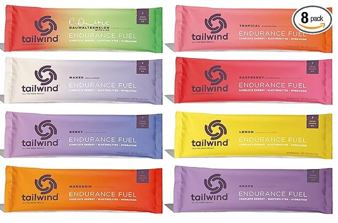
DRINKS AND ELECTROLYTE REPLENISHMENT. From the start, I carried 3+ liters of liquids down the South Kaibab Trail, planning to filter and replenish at Pipe Creek, which flows into the Colorado River around 12 miles, and I could access water regularly at spigots on the eight-mile climb back up Bright Angel. One of those liters was straight Gatorade, one was regular old water, and a third was an electrolyte water that I bought only because I wanted the wide-mouthed bottle for the hike (will talk about that under gear).
I learned about Saltchews, tablets with sodium, potassium, calcium, and magnesium, from the R2R hikers on Facebook and integrated them into my refueling plan. I had always used Hammer Endurolyte capsules and washed them down with water during long-distance runs, and liked that these were chewable (duh — what they’re called Saltchews?). Turns out they’re about the same. What I did not realize (shame on me) until the weekend before the hike is that there is a dangerous downside to taking too many electrolyte replacements, the same as too few, and the symptoms are the same. I had planned on eating them like candy, and now I had one more thing to worry about. Overdosing on electrolytes. The maximum for Saltchews is 15 per day, and so I counted out exactly that many for my little pouch of goodies. Because the heat was a non-factor, I didn’t even eat all of them.
Finally, on the electrolyte and liquid fuel level of the food pyramid, I brought a couple of packs of GU gels to complement the drink and the capsules. GU (and others) make gels with simple and complex carbs, electrolytes, and amino acids, they say. I’ve used them for decades in long-distance runs. Small and easy to carry, rip the top off and squeeze in a mouthful. Some are caffeinated, too. I’ll share my GU selections, and why, in the appendix on all the stuff I carried into the canyon. Enjoy.
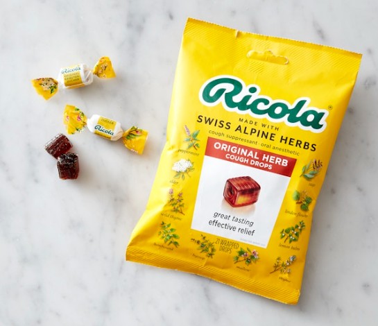
SNACKS. Another surprising lesson from the Facebook R2R hikers was the benefits of a pack of pickles, unbelievably helpful for boosting sodium and warding off cramping calves. I’ve read it’s good and helpful, but I couldn’t bring myself to drink the leftover pickle juice in the pouch. A slice of pizza leftover from dinner the night before at Maswik. Tasted so good to have real food. A giant chocolate chip protein cookie or two and a protein shake. Tootsie Pops (the best) and cough drops to keep moisture in the mouth for long periods. My family chastised me for the selfies with the Tootsie Pop stick hanging out of my mouth. My bad. Gum. Pretzels and crackers, crunchy and salty, although they can be hard to eat later in the day, a little too clumpy, dry, and coagulating.
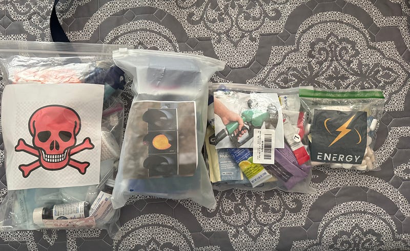
PREPARE FOR THE WORST AND HOPE FOR THE BEST. Rain, heat, cold, dehydration, medical emergencies, unexpected overnight stay, redundant communications, food and fuel, flashlights, and on and on. I’m on lifetime blood thinners and hike with a packet of special clotting gauze, should I tumble and split my head wide open. Mike knew where it was in my backpack. I also have a minor, irritating, sporadic, and undiagnosable heart symptom and carry a small vial with baby aspirin attached to my backpack, should the ticker go. Mike knew where that was, too.
And not just prepare, but also organize and rehearse. The Grand Canyon, in the blazing sun or pitch-black darkness, is no place to be fumbling with gear for the first time. As (retired) professional logisticians, Mike and I enjoyed the planning. What to carry, what works in training hikes, what to leave out, and how to load and carry it. We had spreadsheets with gear, food, calories, and the weight of everything. (Hell, I prepared a checklist for what I would do, in what sequence, upon waking the morning of the Rim to River hike!) Again, just like running marathons, wear nothing, eat nothing, take nothing into the Grand Canyon that hasn’t been tested in a training hike.
Mike and I even had a contingency plan for what we would do if, on the morning of the hike, one of us got wretchedly sick and couldn’t go, or if we reached the Tonto-Bright Angel junction on the way down and one of us didn’t feel well enough to descend to the Colorado River. Would either one continue solo? We had a deal that we would, unless the other party was in distress and needed tending to. It’s best to game that out beforehand, understand your hiking buddy’s expectations (and your own), and not try to strategize on the fly when things go wrong.
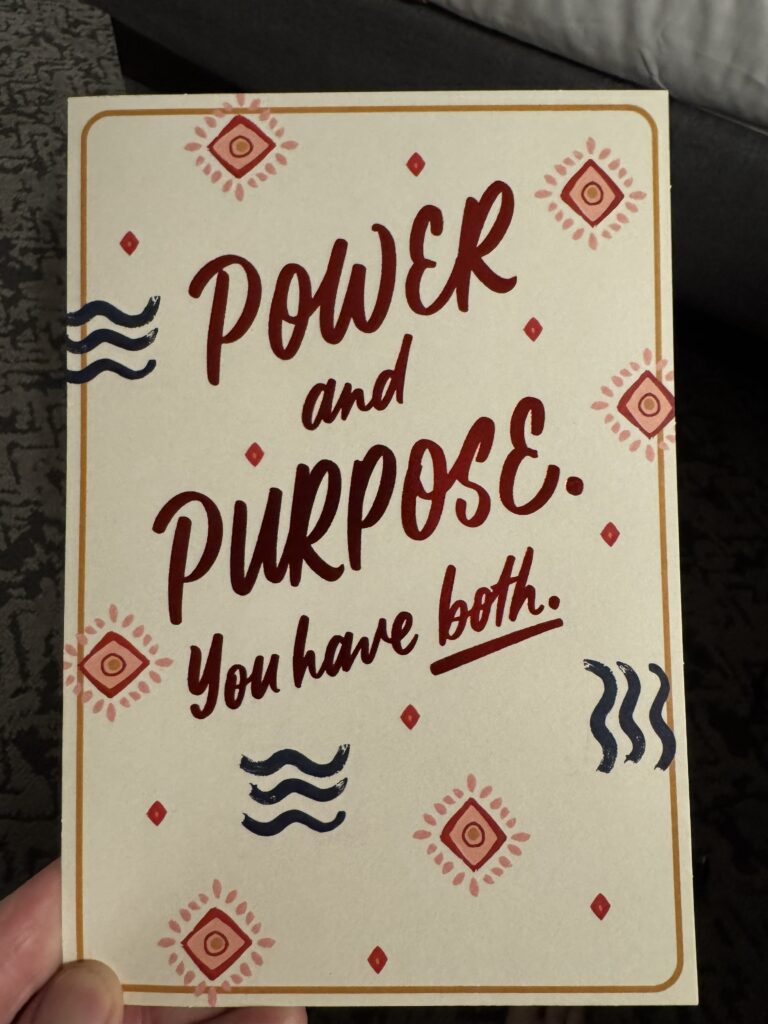
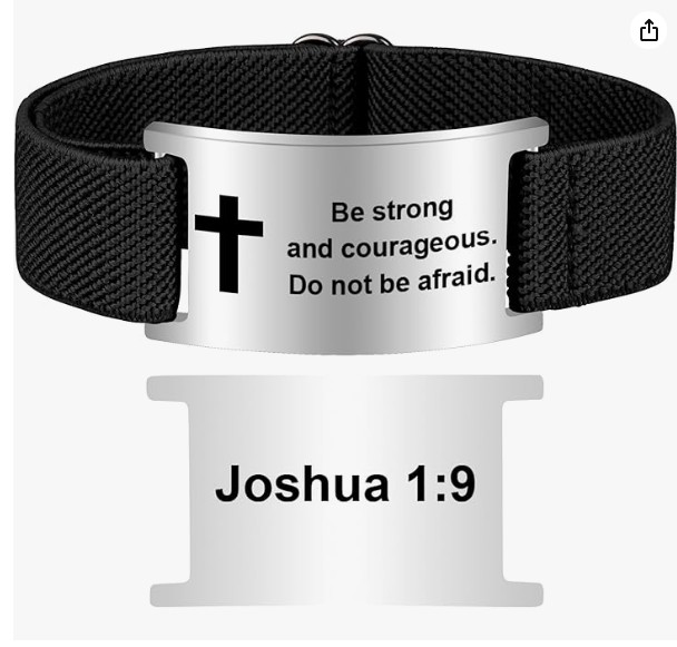
FIND SPIRITUAL AND PSYCHOLOGICAL ENCOURAGEMENT WHEREVER YOU CAN. My wife hid cards in my luggage; one for before the hike and one after. They meant a lot to me. I knew I had her support. I carried an orange bandana/map of the Grand Canyon, that my son gave me, and Mike wore a white one illustrated with magic marker drawings by his granddaughter. I read my Bible app the morning of the hike, and it was stunningly the 23rd Psalm. I had also bought a cheap bracelet on Amazon and wore it that day with Joshua 1:9 on it, “Be strong and courageous. Do not be afraid.” My emergency ID/medical bracelet, for years, also has “Keep Moving Forward” inscribed on it. While I’m a pessimist in real life, for endurance events, I believe in reminding myself, “I got this!” knowing I can gut it out and get it done. And it meant a lot knowing friends and family were tracking the hike live — whether they actually were or not didn’t matter — thinking they were was encouraging.
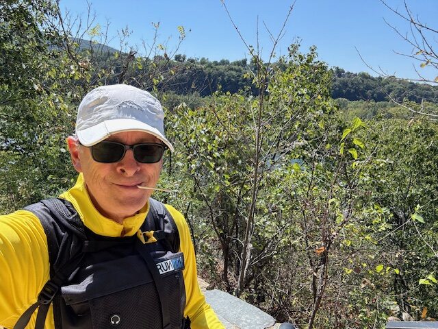
GEAR CHOICES. There were lots of recommendations on the Facebook hiking pages about gear, and I learned a lot from Mike. Some equipment is critical, some is a personal choice, and what makes you feel comfortable and ready, and some is just plain useless. I was comfortable with my choices for the most part. Hoka Speedgoat 5 GTX shoes. Osprey 22 pack. Montem poles. Garmin Fenix 7 Solar watch. Wright Socks (double layer). Cheap but effective shorts and shirt (found a rare SPF hoodie with a ¼ zip to vent when it got warm!). Katadyn BeFree filter. My iPhone satellite text messaging worked deep in the canyon except at the Colorado River because of the cliffs. At the end of this novel, there’s a separate fun addendum about gear, hacks, and tweaks, but I will say I was tremendously pleased with my gear selection and how it all worked.
You can spend a ton on gear. There was a time in late spring when I was still unsure of whether I could or would do the Grand Canyon hike, and was uncomfortable with how much I was spending on gear. I had yet another Amazon cart loaded with supplies and second-guessed myself, deleting small bottles of water purification tablets. If I didn’t do the Grand Canyon, I’d never need these. THEY WERE $2! After the hundreds I spent, I was going to draw the line here?! Stupid. I still held off buying them for another month.
LEARN FROM THE FACEBOOK GROUPS. There is almost no question you have, or I had, and nothing you will face hiking the Grand Canyon that someone hasn’t already been through and probably documented on one of the Facebook groups. There are several, some for training and preparation, some for logistics — people will even offer to swap cars and rides to one rim or the other to help each other out, and many Facebook groups for the hike itself. I’ve been reading the R2R prep and the Grand Canyon Rim-to-Rim Facebook pages for almost 2 years, and I am grateful for all the wisdom and help offered there. Thank you all. Hint — the search function is a good idea before posting.
WHAT WENT WRONG
Almost nothing at all. The hike went very well. Like I wanted it to, and yet better than I ever imagined it could. Probably should phrase this “what could I have done better?” Packing. Despite all my preparations, the night before the hike, my pack weighed in at 17 pounds. My goal all summer was 15 for the Rim to River. But the empty Osprey 22 pack, plus three liters of fluids and nothing else, weighed just over 10 pounds. Not a lot to work with. I reworked my gear over and over the night before the hike and went to bed. The morning of the hike, I filled my bottles with ice, water, and Gatorade, stuffed everything in the pack again…and it weighed 20 pounds. Damn. Does ice weigh more than water?! It was too late to worry about it. I would go in heavy. Besides, I weigh 220 pounds – is another pound or two going to matter?
One minor regret, knowing what I know now? I flew to Phoenix with two small cans of non-alcoholic beer and two mini Diet Cokes. They were ice cold in my hotel room before the hike. I wanted to smuggle one of each into the canyon in my thermal lunch bag and surprise Mike at the Colorado River, asking him, “What could you use right now, a cold Diet Coke or a cold beer?” I’d drink whichever one he didn’t choose. But my bag was already heavy, and I thought that if I failed horribly in the canyon with cans of soft drink or beer in my pack, it would seem terribly irresponsible to have put our months of hiking and the adventure itself at risk just to be clever with a reward for Mike. I left them behind. I now know another half-pound of drinks would have mattered not at all. Next time.
TOO MUCH FOOD. Probably a pound bag of snacks that went untouched. My calculations suggest I ate about 3,500-4,000 calories on the hike and carried over 5,000. For what it’s worth, I probably eat 2,500 calories on an average Sunday watching NFL games in my recliner. I thought I would need more for the hike, but I did not. As with water, there was a fear of not having enough, and I didn’t know any better. Mike had also cautioned that part of our plan included an unexpected medical emergency that might have us overnighting in the canyon, and that would require even more food. Not blaming him for me taking in so much food — I think that’s sound logic. The cool weather really reduced the need for fuel.
GARMIN LIVE TRACKING. Didn’t work like in the training hikes, and my family couldn’t track much. My Garmin Fenix 7 GPS satellite linkup and data collection were superb. Spot on. But the watch relies on the Garmin app on my phone to relay live tracking to the rest of the world, or at least my contacts, and with no cellular signal for much of the hike, there were huge gaps in data transmission to friends and family. Fortunately, Mike’s rented Garmin inReach sent tracking info to his family. He had offered to share the link with mine, but I declined. My family found Garmin Live Tracking to be spotty.
To be fair, I can answer “not much” to what went wrong, both to diligent planning and training, and also due to just dumb luck – again, the great weather. Mike and I didn’t have much flexibility on when to do the hike due to family commitments, zeroed in on September 29th, and went for it. Had the weather shifted to the possible hot or cold extremes, we were prepared, and yet it would have been much harder.
Final Thoughts
I’m writing a companion piece, a practical yet lighthearted review of pretty much everything I carried, or intended to carry, into the Grand Canyon for the Rim-to-River hike. While writing, I remembered “The Things They Carried,” Tim O’Brien’s book about the Vietnam War, using the contents of the soldiers’ packs as metaphors for the burdens of war and beyond. While I would never, ever presume to compare the agony of combat with hiking in the Grand Canyon, writing this piece and reflecting on my hike, it’s not lost on me that what we carry goes beyond what’s in the backpack; it’s also what’s in our hearts and minds along the way. Some very positive and helpful in preparing for and hiking the Grand Canyon, and other things that have to be acknowledged and worked through.
Some say being in the Grand Canyon is a spiritual awakening, and they are forever changed. I don’t know about that. The hike was tough, and while riskier, I wouldn’t say it was harder than the pair of 50-mile ultramarathons I completed. Unlike those, though, here I am three months later still reflecting, and still writing about the Rim to River hike and the months leading up to it. For sure, I have filled in some blanks on my health and fitness. My friendship with Mike has deepened. I can be wistful about not running anymore, and excited about the hiking challenges to come. I’ll be 66 in a couple of months and less confident about taking on risk… but don’t count me out. Maybe I am forever changed, too?
Fabulous. Inspiring. I really appreciate the training “good enough,” which is a stark contrast to what I hear for almost anything like this; experts making non experts feel like feats are impossible unless your train like them. You should write a book about this as it applies to marathons!
Thanks for reading and the kind comments. Now you’re inspiring me!